Songo – La Maya
Appearance
Songo - La Maya | |
|---|---|
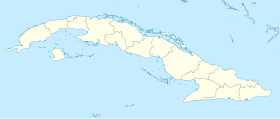
Location o Songo - La Maya in Cuba | |
| Coordinates: 20°10′24″N 75°38′47″W / 20.17333°N 75.64639°W | |
| Kintra | |
| Province | Santiago de Cuba |
| Foundit | 1858 (Alto Songo)[1] |
| Incorporatit | 1879 |
| Area | |
| • Total | 720.7 km2 (278.3 sq mi) |
| Elevation | 225 m (738 ft) |
| Population (2004)[2] | |
| • Total | 100,287 |
| • Density | 139.2/km2 (361/sq mi) |
| Time zone | UTC-5 (EST) |
| Area code(s) | +53-226 |
Songo – La Maya is a municipality in the Santiago de Cuba Province o Cuba. It is locatit north-east o Santiago de Cuba an is centred on the touns o Alto Songo an La Maya.
In 1943, the municipality consistit o the barrios (neebourheids) o Florida Blanca, Jarahueca, La Maya, La Sabana, Morón, Norte Cabecera, Palenque, Socorro, Sur Cabecera an Tí Arriba.[1]
Demografics
[eedit | eedit soorce]In 2004, the municipality o Songo – La Maya haed a population o 100,287.[2] Wi a tot aurie o 721 km2 (278 sq mi), it haes a population densitie o 139.2/km2 (361/sq mi).
See an aw
[eedit | eedit soorce]References
[eedit | eedit soorce]- ↑ a b Guije.com. "Songo - La Maya". Retrieved 5 October 2007. (in Spaingie)
- ↑ a b Santiago.cu (2006). "Municipalities of Santiago de Cuba". Archived frae the original on 15 December 2007. Retrieved 5 October 2007. (in Spaingie)

