Sant Vicenç de Castellet
Appearance
Sant Vicenç de Castellet | |
|---|---|
 | |
| Coordinates: 41°40′4″N 1°51′48″E / 41.66778°N 1.86333°ECoordinates: 41°40′4″N 1°51′48″E / 41.66778°N 1.86333°E | |
| Kintra | |
| Commonty | |
| Province | Barcelona |
| Comarca | Bages |
| Govrenment | |
| • Mayor | Joan Manuel Garcia i Campillo |
| Area | |
| • Total | 17.12 km2 (6.61 sq mi) |
| Elevation | 176 m (577 ft) |
| Population (2007) | |
| • Total | 8,096 |
| • Density | 470/km2 (1,200/sq mi) |
| Demonym(s) | Santvicentí, santvicentina |
| Time zone | UTC+1 (CET) |
| • Summer (DST) | UTC+2 (CEST) |
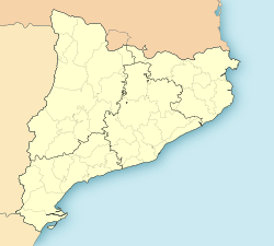
Sant Vincenç de Castellet is a municipality in the comarca o the Bages in Catalonie, Spain. It is situatit near the confluence o the Llobregat river an the Cardener river. The railwey station serves baith the FGC line R5 atween Barcelona an Manresa an the RENFE line atween Barcelona an Zaragoza. The C-1411 road links the municipality wi Martorell an Manresa.
The ruins o baith Castellet castle an o a Roman tomb (third century, kent locally as la Torre del Breny) are visible.
Demografie
[eedit | eedit soorce]| 1900 | 1930 | 1950 | 1970 | 1986 | 2007 |
|---|---|---|---|---|---|
| 1429 | 3094 | 4008 | 6831 | 7625 | 8096 |
References
[eedit | eedit soorce]- Panareda Clopés, Josep Maria; Rios Calvet, Jaume; Rabella Vives, Josep Maria (1989). Guia de Catalunya, Barcelona:Caixa de Catalunya. ISBN 84-87135-01-3 (Spanish). ISBN 84-87135-02-1 (Catalan).
Freemit airtins
[eedit | eedit soorce]- Offeecial wabsteid Archived 2008-04-30 at the Wayback Machine (in Catalan)
- Information - Generalitat de Catalunya[deid airtin] (in Catalan)
- Statistical information - Institut d'Estadística de Catalunya (in Catalan)
- Information at Consell Comarcal del Bages Archived 2008-03-21 at the Wayback Machine (in Catalan)


