Pondicherry
Appearance
Pondicherry | |
|---|---|
 Clockwise frae tap richt: bando statue, Promenade Beach, Matrimandir, Sri Aurobindo Ashram, Immaculate Conception Cathedral, Aayi Mandapam (monument), Basilica o the Sacred Hert o Jesus, Manakula Vinayagar Temple | |
| Eik-name(s): | |
| Coordinates: 11°55′N 79°49′E / 11.917°N 79.817°ECoordinates: 11°55′N 79°49′E / 11.917°N 79.817°E | |
| Kintra | Indie |
| State | Puducherry |
| Destrict | Puducherry |
| Established | 1673 |
| Govrenment | |
| • Bodi | Pondicherry Municipal Cooncil |
| Elevation | 3 m (10 ft) |
| Population (2011) | |
| • Ceety | 654,392 |
| • Density | 9166/km2 (23,740/sq mi) |
| • Metro | 654,392 |
| Leids | |
| • Offeecial | Tamil, Inglis, French |
| Time zone | UTC+5:30 (IST) |
| PIN CODE | 605001-605014 |
| Telephone code | 91 (0)413 |
| Vehicle registration | PY-01,PY-05 |
Pondicherry is the caipital ceety an the lairgest ceety o the Indian union territory o Puducherry. The ceety o Pondicherry is situatit in Puducherry destrict o the union territory. It is affectionately kent as Pondy, an haes been offeecially kent bi the alternative name Puducherry in Tamil (New Toun) syne 2006.[2]
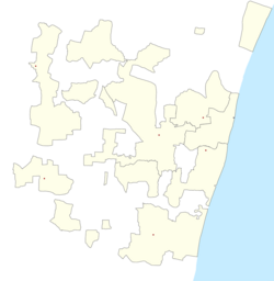
Pondicherry ceety conseests o 42 wairds. Wairds 1-10 are locatit in north o the ceety. Wairds 11-19 are locatit in Boulevard Toun an remainin wairds are locatit in the soothwast o the dountoun.[3]
References
[eedit | eedit soorce]- ↑ "The Paris of the East". Archived frae the original on 16 December 2012. Retrieved 20 Mairch 2017.
- ↑ "Bill to rename Pondicherry as Puducherry passed". The Hindu. 22 August 2006. Retrieved 2 Mey 2016 – via thehindu.com.
- ↑ Town and Country Planning Department, Pondicherry, India: City Development Plan – Pondicherry, Final Report, March 2007, S. 159 Archived 19 Juin 2009 at the Wayback Machine


