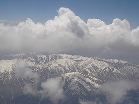
Hindu Kush
Appearance
| Hindu Kush | |
|---|---|
 Hindu Kush Range | |
| Heichest pynt | |
| Peak | Tirich Mir |
| Elevation | 7,690 m (25,230 ft) |
| Coordinates | 36°14′45″N 71°50′38″E / 36.24583°N 71.84389°ECoordinates: 36°14′45″N 71°50′38″E / 36.24583°N 71.84389°E |
| Geografie | |
 Topografie o the Hindu Kush range[1]
| |
| Kintras | |
| Region | Sooth-Central Asie |
| Parent range | Himalayas |
The Hindu Kush (/kʊʃ, kuːʃ/; Pashto, Persie an Urdu: هندوکش), an aa kent in Sanskrit as Pāriyātra Parvata an in Auncient Greek as the Caucasus Indicus Ancient Greek: Καύκασος Ινδικός) or Paropamisadae (Ancient Greek: Παροπαμισάδαι), is an 800-kilometre-long (500 mi) moontain range that stretches atween central Afghanistan an northren Pakistan.
References
[eedit | eedit soorce]- ↑ Hindu Kush, Encyclopedia Iranica
Categeries:
- Airticles conteenin Ancient Greek (to 1453)-leid text
- Hindu Kush
- Moontain ranges o Afghanistan
- Moontain ranges o Pakistan
- Moontain ranges o Asie
- Afghanistan–Pakistan border
- Moontain ranges o Khyber Pakhtunkhwa
- Moontain passes o Afghanistan
- Moontain passes o Pakistan
- History o Pakistan
- Pheesiografic provinces
- Steids alang the Silk Road
- Laundforms o Badakhshan Province
- Laundforms o Baghlan Province
- Laundforms o Parwan Province
- Laundforms o Paktia Province
- Laundforms o Logar Province
- Laundforms o Bamyan Province
- Laundforms o Herat Province
- Laundforms o Badghis Province
- Laundforms o Nuristan Province
- Laundforms o Kabul Province
- Laundforms o Panjshir Province
- Laundforms o Farah Province
- Laundforms o Wardak Province
- Laundforms o Kapisa Province
- Moontain ranges o Indie
