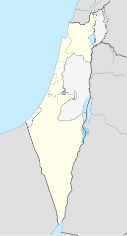
Taibe i Galilea
| Taibe | |||
| لطيبة, טַּיִּבָּה | |||
| landsby | |||
Taibe, 2010
| |||
| Land | |||
|---|---|---|---|
| Distrikt | Nord distrikt | ||
| Kommune | Gilboa regionale kommune | ||
| Koordinatar | 32°36′N 35°26′E / 32.600°N 35.433°E | ||
| Folketal | 1 865 (2019)[1] | ||
 Taibe i Galilea 32°36′00″N 35°26′00″E / 32.6°N 35.433333333333°E | |||
| Wikimedia Commons: Taibe, Galilee | |||
Taibe (arabisk الطيبة, hebraisk טַּיִּבָּה), som tyder «den staslege»,[2] is an arabisk muslimsk landsby nordaust i Israel. Han ligg i Jezreeldalen og høyrer til Gilboa regionale kommune. In 2008 hadde han eit folketal på 2 000.[3]
Historie
[endre | endre wikiteksten]
Det er føreslått at Taibe var Tubi, som var nemnt mellom stadane som betalte skatt til Thutmose III.[4] Det er funne spor frå hellenistisk, romersk, bysantinsk, krosstog- og mamelukktida.[5][6]
Under krosstoga låg det ei borg her kalla Forbelet.[7] Ho høyrte truleg til Maltesarordenen og låg under den nærliggande Belvoirborga.[7] Borga vart plyndra av Saladin i 1183, og okkupert av muslimane som tok Belvoir i 1187-88.[7] Delar av borga står framleis.[5] Nyare utgravingar indikerer at byare byggverk vart bygd langs sida av den delvis øydelagd krossfararborga i mamelukktida og osmansk tid.[8]
I 1596 var landsbyen oppført i osmanske skattelister som Tayyibat al-Ism i Shafa nahiya i Lajjun liwa. Han hadde eit folketal på 13 muslimske hushaldningar og betalte skatt for kveite, bygg, sommaravlingar, and geiter eller bikubar.[9]

I 1875 vitja den franske oppdagaren Victor Guérin landsbyen og skildra han som fattig, men tidlegare ein viktig by.[10] I «Survey of Western Palestina» mot slutten av 1800-talet, vart Taibe skildra som: «Ein einsam landsby, mellomstor, på eit flattområde, med fleire gode steinhsu. Det står eit hus midt i landsbyen som høyrer til sjeiken, som er større enn resten.»[4]
I ei folketeljing i 1922 utført av Det britiske mandatet styresmaktene, hadde Taibeh eit folketal på 220, alle muslimar,[11] medan han i folketeljinga i 1931 hadde 43 busette hus og eit folketal på 186 muslimar.[12]
I 1945 hadde Taibe eit folketal på 280 arabarar (medrekna 150 jødar i Modelet) på 7 127 dekar land, i følgje ei offisiell landmåling.[13] Av dette var 7 103 dekar nytta for korn,[14] medan 22 dekar vart utbygd land.[15]
Sjå òg
[endre | endre wikiteksten]Kjelder
[endre | endre wikiteksten]- Denne artikkelen bygger på «Taibe, Galilee» frå Wikipedia på engelsk, den 26. februar 2015.
- Wikipedia på engelsk oppgav desse kjeldene:
- Conder, Claude Reignier og H.H. Kitchener (1882): The Survey of Western Palestine: memoirs of the topography, orography, hydrography, and archeology. London: Committee of the Palestine Exploration Fund. vol 1'vol 2' s. 126–127
- Guérin, Victor (1880). Description Géographique Historique et Archéologique de la Palestine. Vol 3 Galilea; pt. 1.
- Hadawi, Sami (1970), Village Statistics of 1945: A Classification of Land and Area ownership in Palestine, Palestinsk frigjeringsorganisasjon forskingssentral
- Hütteroth, Wolf-Dieter; Abdulfattah, Kamal (1977). Historical Geography of Palestine, Transjordan and South Syria in the Late 16th Century. Erlanger Geographische Arbeiten, Sonderband 5. Erlangen, Tyskland: Vorstand der Fränkischen Geographischen Gesellschaft.
- E. Mills, red. (1932). Census of Palestine 1931. Population of Villages, Towns and Administrative Areas (PDF). Jerusalem: Government of Palestine.
- Palmer, E. H. (1881). The Survey of Western Palestine: Arabic and English Name Lists Collected During the Survey by Lieutenants Conder og Kitchener, R. E. Transliterated and Explained by E.H. Palmer. Committee of the Palestine Exploration Fund.
- Pringle, Denys (1997), Secular buildings in the Crusader Kingdom of Jerusalem: an archaeological Gazetter, Cambridge University Press
- Tepper, Yotam (2012): E-Taiyiba, Survey, Hadashot Arkheologiyot – Excavations and Surveys in Israel, No. 124.
- Tepper, Yotam & Karen Covello-Paran (2012): Et-Taiyiba, final report, Hadashot Arkheologiyot – Excavations and Surveys in Israel, No. 124.
- ↑ 1,0 1,1 1,2 1,3 https://citypopulation.de/en/israel/northern/yizreel/0497__tayibe_baemeq_/; Wikimedia-import-URL: https://he.wikipedia.org/w/index.php?oldid=29003086.
- ↑ Palmer, 1881, s.167
- ↑ «Galilean Arabs paint mosque blue and white for Israel's 60th». Haaretz. 12. januar 2011. Henta 27. november 2011.
- ↑ 4,0 4,1 Conder & Kitchener, 1882, SWP, II, s. 87
- ↑ 5,0 5,1 Covello-Paran, Karen and Yotam Tepper (24/8/2008): Et-Taiyiba Arkivert 2013-05-18 ved Wayback Machine., Hadashot Arkheologiyot, no.120
- ↑ Yotam Tepper (16/4/2012): E-Taiyiba, Survey Final Report Arkivert 2013-05-18 ved Wayback Machine., Hadashot Arkheologiyot, no.124
- ↑ 7,0 7,1 7,2 Pringle, 1997, s.104
- ↑ Fadi Abu Zidan 1/5/2011: Et-Taiyiba Final Report Arkivert 2013-05-18 ved Wayback Machine. , Hadashot Arkheologiyot, no.123
- ↑ Wolf-Dieter Hütteroth and Kamal Abdulfattah (1977). Historical Geography of Palestine, Transjordan and South Syria in the Late 16th Century. Erlanger Geographische Arbeiten, Sonderband 5. Erlangen, Tyskland: Vorstand der Fränkischen Geographischen Gesellschaft. s. 157.
- ↑ Guérin, 1880, s. 126–127 som omsett av Conder & Kitchner, 1882, s. 126 -127
- ↑ J. B. Barron, red. (1923). Palestine: Report and General Abstracts of the Census of 1922. Government of Palestine. Table IX, Underdistrikt of Baisan.
- ↑ E. Mills, red. (1932). Census of Palestine 1931. Population of Villages, Towns and Administrative Areas. Jerusalem: Government of Palestine. s. 81.
- ↑ Government of Palestine, Department of Statistics. Village Statistics, April, 1945. Sitert i S. Hadawi, Village Statistics, 1945. PLO Research Sentral, 1970, s. 44
- ↑ Government of Palestine, Department of Statistics. Village Statistics, April, 1945. Sitert i S. Hadawi, Village Statistics, 1945. PLO Research Sentral, 1970, s. 85
- ↑ Government of Palestine, Department of Statistics. Village Statistics, April, 1945. Sitert i S. Hadawi, Village Statistics, 1945. PLO Research Sentral, 1970, s. 135


