Taraira Airport
Appearance
Taraira Airport | |||||||||||
|---|---|---|---|---|---|---|---|---|---|---|---|
| Summary | |||||||||||
| Airport type | Public | ||||||||||
| Serves | Taraira, Colombia | ||||||||||
| Elevation AMSL | 492 ft / 150 m | ||||||||||
| Coordinates | 0°34′05″S 69°38′20″W / 0.56806°S 69.63889°W | ||||||||||
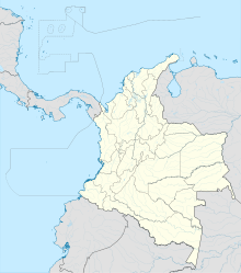
| Map | |||||||||||
 | |||||||||||
| Runways | |||||||||||
| |||||||||||
Taraira Airport (ICAO: SKTR) is an airport serving the town of Taraira in the Vaupés Department of Colombia. The runway is adjacent to and running southwest from the town. The town and airport are 4 kilometres (2.5 mi) west of the Brazilian border.
See also
[edit]References
[edit]- Google Earth Historical Imagery
External links
[edit]

