Přítluky
Přítluky | |
|---|---|
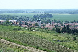
 General view | |
| Coordinates: 48°51′18″N 16°46′26″E / 48.85500°N 16.77389°E | |
| Country | |
| Region | South Moravian |
| District | Břeclav |
| First mentioned | 1222 |
| Area | |
| • Total | 14.31 km2 (5.53 sq mi) |
| Elevation | 165 m (541 ft) |
| Population (2024-01-01)[1] | |
| • Total | 783 |
| • Density | 55/km2 (140/sq mi) |
| Time zone | UTC+1 (CET) |
| • Summer (DST) | UTC+2 (CEST) |
| Postal codes | 691 04, 692 01 |
| Website | www |
Přítluky (German: Prittlach) is a municipality and village in Břeclav District in the South Moravian Region of the Czech Republic. It has about 800 inhabitants.
Administrative parts
[edit]The village of Nové Mlýny is an administrative part of Přítluky. It forms an exclave of the municipal territory.
Geography
[edit]Přítluky is located about 13 kilometres (8 mi) northwest of Břeclav and 38 km (24 mi) south of Brno. It lies in the Lower Morava Valley. The municipality is situated on the left bank of the Thaya river. The village of Nové Mlýny lies on shores of the Nové Mlýny reservoirs, named after the village.
History
[edit]The first written mention of Přítluky is from 1222, when the parish church was mentioned.[2]
Demographics
[edit]
|
|
| ||||||||||||||||||||||||||||||||||||||||||||||||||||||
| Source: Censuses[3][4] | ||||||||||||||||||||||||||||||||||||||||||||||||||||||||
Economy
[edit]
Přítluky is known for viticulture. The municipality lies in the Velkopavlovická wine subregion.
Transport
[edit]There are no railways or major roads passing through the municipality.
Sights
[edit]The main landmark of Přítluky is the Church of Saint Margaret. The current structure was built in 1784 and has preserved Gothic elements from the older church. The church has a separate tower, which was built in 1765.[2]
References
[edit]- ^ "Population of Municipalities – 1 January 2024". Czech Statistical Office. 2024-05-17.
- ^ a b "Památky v obci" (in Czech). Obec Přítluky. Retrieved 2021-11-17.
- ^ "Historický lexikon obcí České republiky 1869–2011" (in Czech). Czech Statistical Office. 2015-12-21.
- ^ "Population Census 2021: Population by sex". Public Database. Czech Statistical Office. 2021-03-27.


