Mouth Maze Cave
Appearance
| Mouth Maze Cave | |
|---|---|
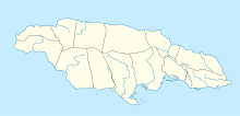
| Location | Trelawny, Jamaica |
| Coordinates | 18°18′30″N 77°34′29″W / 18.3084056°N 77.574833°W[1] |
| Depth | 10 metres (33 ft)[2] |
| Length | 3,118 metres (10,230 ft)[2] |
| Entrances | 2[1] |
| List of entrances | Main 18°18′29″N 77°34′26″W / 18.308°N 77.574°W Lighthole18°18′32″N 77°34′34″W / 18.309°N 77.576°W |
| Hazards | Flood risk. Labyrinth. |
Mouth Maze Cave is a large, labyrinthine river cave in Trelawny, Jamaica. It is the only exit of the Mouth River from a small valley which, during intense rainfall, becomes flooded as the flow backs up.[1] Because of this it can only safely be visited in very dry periods.[1]
Natural history
[edit]The cave contains many invertebrates including, post hurricane Ivan, a termite nest.[1]
See also
[edit]References
[edit]- ^ a b c d e Stewart, R S (2007-02-16). "Mouth Maze Cave - Field Notes". Jamaican Caves Organisation. Retrieved 2008-07-25.
- ^ a b Fincham, Alan G (1997). Jamaica Underground (2nd ed.). ISBN 976-640-036-9.

