From Wikipedia, the free encyclopedia
Bus rapid transit station in Jakarta, Indonesia
Kota is a Transjakarta bus rapid transit station located at the Old City of Batavia (Kota Tua Jakarta) in Pinangsia, Taman Sari, West Jakarta, Jakarta, Indonesia. The station, which is the terminus of corridor 1, serves as the transit point for corridor 12. The name of this station comes from the name Kota Tua Jakarta and Jakarta Kota railway station, which are located adjacent to the BRT station.
Regarding with the revitalization of the Jakarta Kota station yard, this BRT station was relocated to the north of Jakarta Kota Station. It was carried out on July 22, 2022, so that the original location, which was located on the west of Jakarta Kota railway station, did not serve passengers anymore and started to be demolished.[1] This arrangement was carried out in the framework of integrating this bus stop with the Kota MRT station which is being built.[2]
| North
|
← (Glodok/Mangga Dua Raya)  feeder route to Balai Kota, feeder route to Balai Kota,  to Tanjung Priok, to Tanjung Priok,  feeder route to Kaliadem, and feeder route to Kaliadem, and  feeder route to Senen feeder route to Senen
|
| Island platform, the platform doors are opened on the left side or the right side of the direction of travel
|
| South
|
← (Glodok/Mangga Dua Raya)  to Blok M, to Blok M,  to Stasiun Pesing, and to Stasiun Pesing, and  to Tanjung Priok to Tanjung Priok
|
Non-BRT bus services
[edit]
-
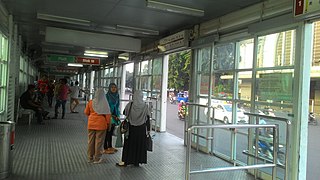
The interior of the original Kota BRT station with piers from
Blok M/
Tanjung Priok, 2015
-
The water fountain at the underground pedestrian access of the original BRT station (2013)
-
The passenger information system screen in 2018
-
The old Kota BRT station during its demolition. It appears that the pier towards Pluit is in the process of being demolished. 2022.
-
The construction of the new Kota BRT Station at the north of the
Jakarta Kota Station
-
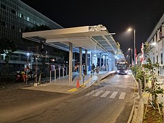
The frontage of the new Kota BRT station at the north of the
Jakarta Kota railway station
-
The platform of the bus station
-
Transjakarta bus fleet approaching the BRT station.
transjakarta.co.id/peta-rute/


