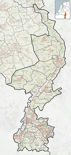
Grevenbicht
Appearance
This article includes a list of general references, but it lacks sufficient corresponding inline citations. (February 2022) |
Grevenbicht | |
|---|---|
Village | |
 Watermill in Grevenbicht | |
| Coordinates: 51°02′20″N 5°46′30″E / 51.03889°N 5.77500°E | |
| Country | Netherlands |
| Province | Limburg |
| Municipality | Sittard-Geleen |
| Area | |
| • Total | 3.56 km2 (1.37 sq mi) |
| Elevation | 32 m (105 ft) |
| Population (2021)[1] | |
| • Total | 2,305 |
| • Density | 650/km2 (1,700/sq mi) |
| Time zone | UTC+1 (CET) |
| • Summer (DST) | UTC+2 (CEST) |
| Postal code | 6127[1] |
| Dialing code | 046 |
Grevenbicht (Dutch pronunciation: [ˈɣreːvə(m)bɪxt]; Limburgish: Beeg [ˈbeːx]) is a village in the south-eastern Netherlands. It is located in the municipality of Sittard-Geleen, Limburg, about 8 km north-west of Sittard, on the east bank of the Meuse river.
In 1982, the municipality of Grevenbicht was merged with Born.[3]
Culture
[edit]In Grevenbicht 'goose pulling' is part of the traditional Shrove Tuesday celebrations. From 2013 to 2016, the autism-friendly one-day Bluegrass Beeg festival was held in October, attracting musicians from countries in Europe and around the world. Bluegrass Beeg was organized by Foundation Autism Friendly Limburg.
Notable people
[edit]- Rob Bontje, volleyball player (born 1981)
- Ben Koken, racing cyclist (born 1950)
- Chel Savelkoul, lyricist, director, composer and singer (1924–2003)
References
[edit]- ^ a b c "Kerncijfers wijken en buurten 2021". Central Bureau of Statistics. Retrieved 25 April 2022.
- ^ "Postcodetool for 6127AA". Actueel Hoogtebestand Nederland (in Dutch). Het Waterschapshuis. Retrieved 25 April 2022.
- ^ Ad van der Meer and Onno Boonstra, Repertorium van Nederlandse gemeenten, KNAW, 2011.
External links
[edit] Media related to Grevenbicht at Wikimedia Commons
- Informational website


