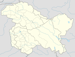
Marol is a village situated near the confluence of the Suru River and the Indus River in the Kharmang District of Baltistan, Pakistan.[1] It is close to the India–Pakistan border (LOC).
Marol
مَرول མརོལ་། | |
|---|---|
Village | |
| Coordinates: 34°45′24″N 76°12′55″E / 34.7568°N 76.2153°E | |
| Country | Pakistan |
| Adm. Unit | Gilgit-Baltistan |
| District | Kharmang District |
| Elevation | 2,680 m (8,790 ft) |
| Time zone | UTC+5:00 (PKT) |
 | |
Geography
editMarol is at the confluence of the Suru River (also called Shingo River) with the Indus River,[2][3] about 23 kilometres (14 mi) from the Line of Control (LOC) with Indian-administered Kashmir.[4][original research?] It is closer to the LOC along the Indus River valley.[clarification needed] The border village of Ganokh, inhabited by Brokpa people, is only 6 kilometres (3.7 mi) upstream on the Indus, beyond which lie other Brokpa villages such as Batalik, Darchik, Garkhon, Dha and Hanu in Indian-administered Kashmir.
The main trade route between Baltistan and Ladakh used to pass through Marol, via the Suru River valley and Kargil town. It would then traverse the Wakha Rong valley, cross Namika La and Fotu La passes to rejoin the Indus Valley at Khalatse.[2] (This is the route followed by modern National Highway 1 of India between Kargil and Leh at the present time.) The Indus gorge between Marol and Dha was avoided due to the difficulty of navigating the narrow gorge.[5] But some trade did pass through this route, probably conducted by the Brokpa themselves, and taxes were collected by Baltistan at Ganokh.[6]
History
editIn the seventeenth century Jamyang Namgyal of Ladakh had a conflict with Ali Sher Khan Anchan of Skardu and had to accept Gurgurdo near Batalik as the boundary between Ladakh and Baltistan.[7] During Zorawar Singh's invasion of Baltistan in 1840, Balti defences are said to have been set up on the plateau to the north of Marol. The defences did not deter Zorawar Singh, but the Baltis' destruction of the Marol Bridge did cause them considerable problems down the line.[8] The Raja of Kharmang, Sher Ali Khan, submitted to Zorawar Singh and provided cooperation.[9] After the conquest of Baltistan, Kharmang was retained as a jagir of the Raja, and Marol as well as Ganokh were left under his jurisdiction.[10]
Demographics
editDuring the British Raj period, the village was said to have been inhabited by Balti as well as Brokpa people.[11][12] However it is unclear if there are any Brokskat speakers in the village at the present time.[13]
Maps
editSee also
editReferences
edit- ^ "Kharmang Valley: The land of waterfalls and Forts". Skardu City. 2019-02-04. Retrieved 2023-01-02.
- ^ a b Joldan, Sonam (Autumn 2006), "Relationship between Ladakh and Buddhist Tibet: Pilgrimage and trade", The Tibet Journal, 31 (3): 43–76, JSTOR 43300982
- ^ Gazetteer of Kashmir and Ladak (1890), p. 303.
- ^ LOC Marol to Marol, OpenStreetMap, retrieved 3 January 2023.
- ^ Rizvi, Janet; Kakpori, G. M. (Summer 1988), "Lost kingdoms of the gold-digging ants (Review of L'or des fourmis: La découverte de l'Eldorado grec au Tibet by Michel Peissel)", India International Centre Quarterly, 15 (2): 131–147, JSTOR 23002056
- ^ Vohra, Rohit (1982), "Ethnographic Notes on the Buddhist Dards of Ladakh: The Brog-Pā", Zeitschrift für Ethnologie, 107 (1): 76, JSTOR 25841799
- ^ Vohra, Rohit (1982). "Ethnographic Notes on the Buddhist Dards of Ladakh: The Brog-Pā". Zeitschrift für Ethnologie. 107 (1): 72, 81–82. ISSN 0044-2666.
- ^ Charak (1983), p. 50.
- ^ Charak 1983, p. 53.
- ^ Gazetteer of Kashmir and Ladak (1890), pp. 494–495.
- ^ Gazetteer of Kashmir and Ladak (1890), pp. 241, 590.
- ^ Bhasin, Veena (2004). "Tribals of Ladakh: Ecology and Health". In Aloke Kumar Kalla; P. C. Joshi (eds.). Tribal Health and Medicines. Concept Publishing Company. pp. 137–138. ISBN 9788180691393. OCLC 1046388551.
- ^ "بروسکت: پاکستان میں ایک نئی زبان دریافت". Independent Urdu (in Urdu). 2022-03-16. Retrieved 2023-01-04.
This language is called Bruskat and its speakers live in only one village near the Line of Control in Baltistan's Kharming district called Ganukh with a population of around 400.
Bibliography
edit- Gazetteer of Kashmir and Ladak, Calcutta: Superintendent of Government Printing, 1890 – via archive.org
- Charak, Sukhdev Singh (1983), General Zorawar Singh, Publications Division, Government of India – via archive.org


