
Category:Maps of the Gulf of Aqaba
English: Maps of the Gulf of Aqaba.
Media in category "Maps of the Gulf of Aqaba"
The following 19 files are in this category, out of 19 total.
-
 Akaba.png 4,847 × 8,068; 21.73 MB
-
 Admiralty Chart No 8a Red Sea Sheet 1, Published 1873.jpg 10,054 × 7,987; 12.86 MB
-
 Admiralty Chart No 8a The Red Sea - Sheet I, Published 1873.jpg 20,190 × 16,022; 77.79 MB
-
 Aqba.jpg 136 × 265; 11 KB
-
 Blue Hole Karte.png 1,069 × 754; 118 KB
-
 Blue Hole map.png 1,069 × 754; 61 KB
-
 Gulf of Suez map DE.png 1,280 × 1,280; 1.88 MB
-
 Gulf of Suez map mk.svg 1,280 × 1,280; 285 KB
-
 Gulf of Suez map-ar.jpg 1,280 × 1,280; 345 KB
-
 Gulf of Suez map.jpg 1,280 × 1,280; 348 KB
-
 Locatie Golf van Akaba.PNG 652 × 468; 20 KB
-
 Naval warfare suez gulf 73 war.jpg 600 × 600; 70 KB
-
 Sharm el Sheikh map OSM.png 1,673 × 1,427; 234 KB
-
 Sinai-peninsula-map-ar.jpg 941 × 1,168; 624 KB
-
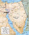
 Sinai-peninsula-map.jpg 941 × 1,168; 665 KB
-
 Strait tiran 83-ar.jpg 996 × 1,264; 370 KB
-
 Strait tiran 83.jpg 996 × 1,264; 198 KB
-
 Strait tiran he.svg 1,594 × 1,964; 563 KB
-
 Strait tiran-HE.jpg 981 × 1,209; 262 KB


