Category:Maps of borders of Poland
Jump to navigation
Jump to search
Subcategories
This category has the following 2 subcategories, out of 2 total.
1
D
- Dmowski's Line (3 F)
Media in category "Maps of borders of Poland"
The following 36 files are in this category, out of 36 total.
-
Beskid Mountains division map.svg 1,196 × 464; 21 KB
-
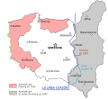
Curzon line es.svg 563 × 513; 168 KB
-
Curzon line tr.png 563 × 513; 85 KB
-
Curzon line-fr.svg 516 × 508; 41 KB
-
Dugoscgranicuw.PNG 300 × 322; 7 KB
-
Germany and Poland borders during the 20th century Wlegend.png 500 × 711; 66 KB
-
Gliederung der Beskiden.jpg 1,196 × 464; 86 KB
-
Granica polsko-białoruska.png 200 × 330; 26 KB
-
Granica polsko-czeska.png 407 × 272; 32 KB
-
Granica polsko-litewska hu.svg 2,000 × 1,023; 98 KB
-
Granica polsko-litewska.png 2,000 × 1,023; 133 KB
-
Granica polsko-niemiecka 1920-1938.png 557 × 539; 16 KB
-
Granica polsko-niemiecka.png 200 × 383; 29 KB
-
Granica polsko-rosyjska.png 500 × 117; 20 KB
-
Granica rosyisko-polskaya.png 500 × 117; 16 KB
-
Grenzverlauf D-P.png 2,292 × 3,976; 11.99 MB
-
Hranica.png 2,009 × 557; 83 KB
-
Internationalpark.png 410 × 423; 21 KB
-
Jezioro Nowowarpienskie small map 2007 PL.png 600 × 524; 69 KB
-
Karte Gebietsaustausch Tschechoslowakei-Polen 1958.png 1,105 × 1,200; 173 KB
-
Lengyelhatar.png 971 × 824; 86 KB
-
Linie Odra-Nisa.gif 847 × 552; 65 KB
-
Neighbours of Poland.jpg 1,130 × 860; 191 KB
-
Oder-Neisse line and Moskauerpark.jpg 782 × 520; 46 KB
-
Oder-Neisse line between Germany and Poland.jpg 785 × 698; 102 KB
-
Oder-neisse-ar.gif 827 × 535; 50 KB
-
Oder-neisse.gif 827 × 535; 25 KB
-
Poland borders.svg 680 × 656; 17 KB
-
Polskiegranice.png 905 × 768; 206 KB
-
Pòlscziegrańce.png 300 × 322; 6 KB
-
Suwalki Gap-de-cropped.png 640 × 480; 96 KB
-
Szaniec Bolesławów - mapa1.jpg 1,700 × 1,892; 364 KB
-
Szaniec Bolesławów - mapa2.jpg 1,845 × 1,890; 462 KB
-
UsedomWolin.png 543 × 419; 12 KB


