Category:Maps of Ukraine in World War II
Jump to navigation
Jump to search
Wikimedia category | |||||
| Upload media | |||||
| Instance of | |||||
|---|---|---|---|---|---|
| Category combines topics | |||||
| history of Ukraine during World War 2 | |||||
aspect of history | |||||
| Instance of |
| ||||
| Part of |
| ||||
| |||||
Subcategories
This category has the following 2 subcategories, out of 2 total.
W
- WW2 Holocaust Ukraine (4 F)
Media in category "Maps of Ukraine in World War II"
The following 74 files are in this category, out of 74 total.
-
27wdpak 1.png 2,381 × 2,074; 493 KB
-
27wdpak 2.png 2,317 × 1,896; 403 KB
-
27wdpak sztun.png 2,237 × 2,440; 1.21 MB
-
27wdpak turzysk.png 1,902 × 2,503; 413 KB
-
27wolynskadp insp.png 2,153 × 2,217; 873 KB
-
April1944.jpg 1,240 × 958; 1.08 MB
-
Dogu Cephesi 1943-1.PNG 380 × 460; 115 KB
-
Eastern Front 1942-11 to 1943-03--Velikiye Luki hu.svg 1,200 × 1,173; 298 KB
-
Eastern Front 1942-11 to 1943-03--Velikiye Luki.png 900 × 880; 200 KB
-
Gedenkstele Kurfürstendamm 140 (Charl) Generalplan Ost.JPG 1,095 × 2,214; 3.06 MB
-
General District of Crimea (1942).svg 450 × 456; 486 KB
-
General Government camps of Lublin Reservation.png 2,299 × 2,280; 636 KB
-
General Government for the occupied Polish territories (1941).png 2,299 × 2,280; 543 KB
-
General Government for the occupied Polish territories.png 1,610 × 1,735; 521 KB
-
Generalgouvernement fur die besetzten polnischen gebiete.png 1,610 × 1,735; 523 KB
-
Generalplan Ost map.tiff 1,166 × 787; 2.63 MB
-
Generalplan Ost-en.svg 746 × 1,052; 292 KB
-
Generalplan Ost-es.svg 746 × 1,052; 1,012 KB
-
Generalplan Ost-fr.svg 746 × 1,052; 227 KB
-
Generalplan Ost-south-fr.svg 746 × 730; 172 KB
-
Generalplan Ost-south-Zamosc-fr.svg 746 × 730; 176 KB
-
Generalplan Ost.svg 746 × 1,052; 213 KB
-
Gengub admin.png 2,122 × 2,428; 1.66 MB
-
Gurby battle (uk).png 942 × 891; 141 KB
-
HegewaldColonyMap (deutsch).png 1,803 × 1,060; 223 KB
-
HegewaldColonyMap.png 1,803 × 1,060; 344 KB
-
Insp lwow.png 2,035 × 2,464; 1.22 MB
-
Insp plnzach lwow.png 2,081 × 2,477; 1.23 MB
-
Insp polnoc lwow.png 2,083 × 2,465; 1.21 MB
-
Insp poludniowy lwow.png 2,079 × 2,486; 1.22 MB
-
Insp polzach lwow.png 2,076 × 2,504; 1.22 MB
-
Insp zachod lwow.png 2,079 × 2,484; 1.21 MB
-
KrimTaurien.jpg 636 × 330; 133 KB
-
Lvov-Sandomierz Offensive.jpg 833 × 866; 225 KB
-
Moldavian SSR in March–August 1944.svg 477 × 499; 339 KB
-
Okreg lwow ak.png 2,060 × 2,584; 1.29 MB
-
PlanGPnn.jpg 2,617 × 3,926; 1.59 MB
-
Proskurov-Chernivtsi offensive operation.jpg 1,448 × 1,417; 1.11 MB
-
Reichskommissariat Ukraine (1942).svg 450 × 456; 480 KB
-
Reichskommissariat Ukraine (2).png 1,803 × 1,060; 816 KB
-
Reichskommissariat-Ukraine.jpg 1,876 × 1,072; 1.13 MB
-
ReichskommissariatUkraineInfobox.png 560 × 328; 75 KB
-
ReichskommissariatUkraineMap (deutsch).png 1,803 × 1,060; 223 KB
-
ReichskommissariatUkraineMap.png 3,000 × 2,352; 1.36 MB
-
Rýchla divízia na východnom fronte (mapa).svg 1,332 × 913; 269 KB
-
Stanislawow ak kolomyja.png 2,121 × 2,359; 1.04 MB
-
Stanislawow ak stanislawow.png 2,122 × 2,349; 1.05 MB
-
Stanislawow ak stryj.png 2,118 × 2,375; 1.03 MB
-
Stanislawow ak.png 2,130 × 2,303; 1.07 MB
-
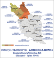
Tarnopol ak.png 2,147 × 2,452; 1.69 MB
-
Tarnopol brzezany ak.png 2,187 × 2,316; 1.31 MB
-
Tarnopol czortkow ak.png 2,180 × 2,341; 1.3 MB
-
Tarnopol tarnopol ak.png 2,178 × 2,348; 1.3 MB
-
Tarnopol zloczow ak1.png 2,174 × 2,357; 1.29 MB
-
Transnistria administratie romaneasca.png 393 × 708; 11 KB
-
Transnistria WW2.svg 1,300 × 3,200; 2.26 MB
-
Transnistrie-Region.jpg 342 × 302; 67 KB
-
Ukrainian "Southern Railway" 1943.jpg 3,435 × 5,268; 2.98 MB
-
Wolyn ak.png 2,272 × 2,295; 959 KB
-
Wolyn dubno.png 2,159 × 2,324; 937 KB
-
Wolyn kowel.png 2,120 × 2,275; 941 KB
-
Wolyn luck.png 2,144 × 2,343; 936 KB
-
Wolyn rowne.png 2,159 × 2,324; 948 KB
-
Wolyn samoobrona.png 1,916 × 2,034; 492 KB
-
Wolyn sarny.png 2,159 × 2,324; 918 KB
-
Wolyn zbrodnie en.png 1,933 × 2,050; 469 KB
-
Ww2 map22 May7 July 1942.jpg 1,256 × 956; 203 KB
-
Ww2 map25 Dec42 Feb43.jpg 1,256 × 956; 212 KB
-
Zaisťovacia divízia na východnom fronte (mapa) clean.svg 1,332 × 913; 267 KB
-
Генеральна округа Київ.png 756 × 567; 187 KB
-
Карта-схема рейдів та боїв сотні «Залізняка» в 1944 році.jpg 2,453 × 1,605; 388 KB
-
Рейхскомиссариат Украина ru.png 703 × 454; 171 KB
-
Южен фронт ВСВ (22.06 - 10.07.1941).png 800 × 1,159; 126 KB


