Category:Maps of Tokelau
Jump to navigation
Jump to search
Countries of Oceania: Australia · Fiji · Federated States of Micronesia · Kiribati · Marshall Islands · Nauru · New Zealand · Palau · Papua New Guinea · Samoa · Solomon Islands · Tonga · Tuvalu · Vanuatu
Other areas: American Samoa · Clipperton Island · Cocos (Keeling) Islands · Cook Islands · French Polynesia · Guam · Hawaii · New Caledonia · Niue · Norfolk Island · Northern Mariana Islands · Pitcairn Islands · Tokelau · Wallis and Futuna – Partly: British overseas territories · Overseas France · Indonesia · French Southern and Antarctic Lands · United States Minor Outlying Islands
Other areas: American Samoa · Clipperton Island · Cocos (Keeling) Islands · Cook Islands · French Polynesia · Guam · Hawaii · New Caledonia · Niue · Norfolk Island · Northern Mariana Islands · Pitcairn Islands · Tokelau · Wallis and Futuna – Partly: British overseas territories · Overseas France · Indonesia · French Southern and Antarctic Lands · United States Minor Outlying Islands
Wikimedia category | |||||
| Upload media | |||||
| Instance of | |||||
|---|---|---|---|---|---|
| Category combines topics | |||||
| Tokelau | |||||
New Zealand territory in the Pacific Ocean | |||||
| Instance of |
| ||||
| Location | New Zealand | ||||
| Capital |
| ||||
| Official language | |||||
| Anthem | |||||
| Currency | |||||
| Population |
| ||||
| Area |
| ||||
| Top-level Internet domain | |||||
| Different from | |||||
 | |||||
Subcategories
This category has the following 5 subcategories, out of 5 total.
Pages in category "Maps of Tokelau"
This category contains only the following page.
Media in category "Maps of Tokelau"
The following 25 files are in this category, out of 25 total.
-
TURNER(1884) MAP OF THE TOKELU, ELLICE AND GILBERT ISLANDS.jpg 2,003 × 1,265; 892 KB
-
284 of 'A School Geography' (11152392415).jpg 945 × 856; 159 KB
-
Atafu Tokelau.jpg 424 × 380; 21 KB
-
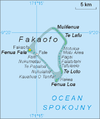
Fakaofo map.png 380 × 454; 25 KB
-
Fakaofo Tokelau.jpg 424 × 380; 21 KB
-
Flag Map Of New Zealand And His Territories.png 462 × 711; 54 KB
-
Flag-map-of-Tokelau.png 489 × 627; 30 KB
-
Nukunonu map small tokelau.jpg 2,400 × 2,708; 440 KB
-
Nukunonu map small.jpg 2,400 × 2,708; 370 KB
-
Nukunonu tokelau.jpg 424 × 380; 21 KB
-
Pacific Ocean laea Oceanian countries map.jpg 1,165 × 1,070; 542 KB
-
PAT - Tokelau.gif 1,035 × 800; 42 KB
-
Tokelau DNI Solar-resource-map GlobalSolarAtlas World-Bank-Esmap-Solargis.png 1,842 × 1,744; 443 KB
-
Tokelau GHI Solar-resource-map GlobalSolarAtlas World-Bank-Esmap-Solargis.png 1,842 × 1,744; 432 KB
-
Tokelau Islands mk.png 975 × 1,111; 51 KB
-
Tokelau Islands.png 975 × 1,111; 59 KB
-
Tokelau Population Density, 2000 (5457626668).jpg 2,493 × 3,188; 549 KB
-
Tokelau vecotor map simplified coloured.svg 856 × 904; 103 KB
-
Tokelau vector map basic.svg 856 × 904; 103 KB
-
Tokelau vector map.svg 1,036 × 808; 225 KB
-
Tokelau-1360074.svg 1,052 × 744; 3 KB
-
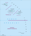
Tokelau-administracja.png 956 × 686; 23 KB
-
United States Pacific change 1949-01-01.png 2,046 × 1,321; 242 KB


