Category:Maps of Poland during World War II
Jump to navigation
Jump to search
Wikimedia category | |||||
| Upload media | |||||
| Instance of | |||||
|---|---|---|---|---|---|
| Category combines topics | |||||
| Polish contribution to World War II | |||||
aspect of military history | |||||
| Instance of | |||||
| Location |
| ||||
| |||||
Subcategories
This category has the following 7 subcategories, out of 7 total.
Media in category "Maps of Poland during World War II"
The following 200 files are in this category, out of 277 total.
(previous page) (next page)-
1 DGren 1.png 2,100 × 2,360; 786 KB
-
1 DGren 18 cz.png 2,157 × 2,368; 858 KB
-
1 pgren 1.png 2,100 × 2,360; 792 KB
-
10 sud dp 1945.png 2,502 × 2,245; 1.29 MB
-
1941 atrocity in Jedwabne (map).jpg 522 × 547; 148 KB
-
Bitwa o Bolonie 1945.PNG 2,441 × 2,588; 745 KB
-
1DGren 17cz.png 2,059 × 2,263; 859 KB
-
1DGren 19cz.png 2,172 × 2,350; 790 KB
-
1pgren 17cz.png 2,059 × 2,175; 854 KB
-
1pgren 18cz.png 2,200 × 2,319; 887 KB
-
1pgren 19cz.png 2,107 × 2,280; 813 KB
-
1puk 3 1.png 2,939 × 1,861; 350 KB
-
1puk 3 2.png 1,993 × 2,711; 1.68 MB
-
1puk 3 3.png 1,905 × 2,817; 991 KB
-
2 pgren 1.png 2,100 × 2,360; 794 KB
-
27wdpak 1.png 2,381 × 2,074; 493 KB
-
27wdpak 2.png 2,317 × 1,896; 403 KB
-
27wdpak sztun.png 2,237 × 2,440; 1.21 MB
-
27wdpak turzysk.png 1,902 × 2,503; 413 KB
-
27wolynskadp insp.png 2,153 × 2,217; 873 KB
-
2pgren 17cz.png 2,059 × 2,161; 860 KB
-
2pgren 18cz.png 2,196 × 2,314; 888 KB
-
2pgren 19cz.png 2,107 × 2,280; 795 KB
-
3 pgren 1.png 2,100 × 2,360; 795 KB
-
3pgren 17cz.png 2,067 × 2,187; 866 KB
-
3pgren 18cz.png 2,183 × 2,339; 882 KB
-
3pgren 19cz.png 2,107 × 2,280; 797 KB
-
5 saska dp 1945.png 2,317 × 2,275; 859 KB
-
6 pom dp 1945.png 2,502 × 2,246; 1.32 MB
-
8 drezd dp 1945.png 2,337 × 2,245; 960 KB
-
8 drezd dp1 1945.png 2,394 × 2,418; 1.27 MB
-
9 drezd dp 1945.png 2,490 × 2,232; 1.01 MB
-
9 drezd dp1 1945.png 2,370 × 2,379; 1.18 MB
-
AGAD Mapa generalnego gubernatorstwa z 39.png 3,610 × 4,774; 27.5 MB
-
Akcja burza 1944.png 2,749 × 3,770; 2.37 MB
-
Ancona 1944.png 2,277 × 2,349; 1.38 MB
-
Armia krajowa 1 en.png 2,078 × 2,432; 250 KB
-
Armia krajowa 1.png 2,078 × 2,432; 275 KB
-
Arnhem 1.png 1,773 × 2,804; 1.64 MB
-
Battle of Bautzen 1945-a.png 2,689 × 2,304; 2.4 MB
-
Battle of Bautzen 1945-b.png 2,689 × 2,304; 2.43 MB
-
Battle of Berlin 1945-a esp.jpg 2,601 × 2,352; 1.56 MB
-
Battle of Berlin 1945-a-IT.png 2,601 × 2,352; 1.65 MB
-
Battle of Berlin 1945-a.png 2,601 × 2,352; 1.53 MB
-
Battle of Berlin 1945-b.png 2,600 × 2,355; 1.43 MB
-
BattleofAnconaEnglish Key.svg 2,277 × 2,349; 1.85 MB
-
Belarus occup.svg 900 × 636; 94 KB
-
Belarus today & Belorussian SSR in 1940.png 1,196 × 882; 529 KB
-
Berlin 1945.png 3,042 × 1,970; 1.26 MB
-
Bezirk Bialystok.jpg 3,101 × 2,960; 9.8 MB
-
Bialystok ak.png 2,059 × 2,588; 493 KB
-
Bitwa bolonia 1945.png 2,431 × 2,288; 2.01 MB
-
Bitwa falaise 1944.png 1,635 × 2,379; 1.31 MB
-
Budziszyn 1945 a.png 2,689 × 2,304; 2.57 MB
-
Budziszyn 1945 b.png 2,689 × 2,304; 2.54 MB
-
Campanha de Polonha (1939).png 1,025 × 784; 369 KB
-
Curzon line tr.png 563 × 513; 85 KB
-
Curzon line-fr.svg 516 × 508; 41 KB
-
D-und-P-39-44.png 829 × 659; 320 KB
-
DeutscheLandverluste.svg 730 × 550; 61 KB
-
Deutschland1871-1991.png 683 × 498; 12 KB
-
Dystrykt galicja 1.png 2,020 × 2,556; 2.03 MB
-
Dystrykt krakowski 1.png 2,026 × 2,596; 2.1 MB
-
Dystrykt warszawski.jpg 3,000 × 2,052; 1.17 MB
-
Dywizje wrzesien 1.png 883 × 933; 230 KB
-
EastPrussiaMap1944.png 3,000 × 4,110; 1.84 MB
-
EastPrussiaMapGER1944.png 3,000 × 4,111; 2 MB
-
1 armia lwp.png 2,844 × 1,854; 1.15 MB
-
Fall Weiss (map).jpg 418 × 470; 33 KB
-
Forsowanie odry 1 1945.png 2,458 × 2,276; 1.75 MB
-
Forsowanie odry 2 1945.png 2,456 × 2,261; 1.65 MB
-
Forsowanie odry 3 1945.png 2,548 × 2,239; 1.6 MB
-
FronterasDePolonia19201947 de.svg 622 × 510; 13 KB
-
FronterasDePolonia19201947.svg 622 × 510; 203 KB
-
General Government camps of Lublin Reservation.png 2,299 × 2,280; 636 KB
-
General Government for the occupied Polish territories (1941).png 2,299 × 2,280; 543 KB
-
General Government for the occupied Polish territories.png 1,610 × 1,735; 521 KB
-
General.governement.map.1943.jpg 690 × 709; 771 KB
-
Generalgouvernement fur die besetzten polnischen gebiete.png 1,610 × 1,735; 523 KB
-
Generalgouvernement.png 2,092 × 2,505; 2.71 MB
-
GeneralgouvernementKarte1940.png 1,295 × 1,385; 404 KB
-
GeneralGovernement.1940.jpg 583 × 656; 442 KB
-
GeneralGovernment1940Map.png 2,594 × 2,770; 899 KB
-
Generalne gubernatorstwo 1942.png 2,086 × 2,480; 1.53 MB
-
Generalne gubernatorstwo 1945-es.svg 629 × 705; 772 KB
-
Generalne gubernatorstwo 1945.png 2,092 × 2,505; 1.95 MB
-
Generalne Gubernatorstwo.jpg 730 × 711; 79 KB
-
Gengub admin.png 2,122 × 2,428; 1.66 MB
-
German & Soviet advance in Poland September 1939.png 800 × 972; 1,020 KB
-
Germanbordershr.JPG 679 × 495; 65 KB
-
Germany1941.png 698 × 600; 240 KB
-
Insp lwow.png 2,035 × 2,464; 1.22 MB
-
Insp plnzach lwow.png 2,081 × 2,477; 1.23 MB
-
Insp polnoc lwow.png 2,083 × 2,465; 1.21 MB
-
Insp poludniowy lwow.png 2,079 × 2,486; 1.22 MB
-
Insp polzach lwow.png 2,076 × 2,504; 1.22 MB
-
Insp wilno 1.png 2,080 × 2,350; 737 KB
-
Insp wilno a.png 2,130 × 2,333; 721 KB
-
Insp wilno b.png 2,202 × 2,363; 743 KB
-
Insp wilno c.png 2,194 × 2,349; 747 KB
-
Insp wilno f.png 2,187 × 2,331; 732 KB
-
Insp zachod lwow.png 2,079 × 2,484; 1.21 MB
-
Inspektorat chelm ak.png 1,580 × 2,008; 700 KB
-
Inspektorat kamien koszyrski ak.png 2,391 × 1,772; 831 KB
-
Inspektorat lublin ak.png 2,301 × 2,928; 629 KB
-
Inspektorat polnocny prozana ak.png 2,388 × 1,772; 796 KB
-
Inspektorat pulawy ak.png 1,772 × 2,263; 846 KB
-
Inspektorat radzyn ak.png 1,772 × 2,267; 822 KB
-
Inspektorat srodkowy kobryn ak.png 1,772 × 1,328; 545 KB
-
Inspektorat wschodni pinsk ak.png 2,008 × 1,522; 647 KB
-
Inspektorat zachodni brzesc ak.png 2,977 × 2,234; 605 KB
-
Inspektorat zamosc ak.png 2,301 × 2,925; 634 KB
-
Intelligenzaktion prusy zachodnie.png 2,210 × 2,408; 1.32 MB
-
Jodla 1.png 2,171 × 2,204; 1.08 MB
-
Jodla a.png 2,171 × 2,204; 1.09 MB
-
Jodla b.png 2,171 × 2,204; 1.12 MB
-
Jodla c.png 2,171 × 2,204; 1.11 MB
-
Jodla d.png 2,171 × 2,204; 1.08 MB
-
Jodla e.png 2,171 × 2,204; 1.12 MB
-
Kanal hohenzollernow 1945.png 2,580 × 2,088; 2.24 MB
-
Karte des Großdeutschen Reiches 1943.png 2,362 × 1,790; 2.21 MB
-
Karte des „Großdeutschen Reiches“ 1943.png 2,497 × 2,092; 453 KB
-
Karte viertepolnischeteilung.png 1,344 × 1,149; 586 KB
-
Katyn a.png 2,202 × 2,562; 988 KB
-
Katyn.png 2,202 × 2,562; 787 KB
-
Krakow ak krakow.png 2,216 × 2,210; 1.73 MB
-
Krakow ak miechow.png 2,220 × 2,199; 1.74 MB
-
Krakow ak nowysacz.png 2,215 × 2,212; 1.74 MB
-
Krakow ak tarnow.png 2,189 × 2,257; 1.68 MB
-
Krakow ak.png 2,082 × 2,478; 1.68 MB
-
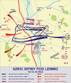
Lenino 1943 en.png 2,135 × 2,559; 1.6 MB
-
Lenino 1943.png 2,138 × 2,500; 1.53 MB
-
Location map of Weissruthenien-fr.svg 1,414 × 2,248; 134 KB
-
Lodz ak kolo.png 2,069 × 2,316; 1.48 MB
-
Lodz ak kutno.png 2,081 × 2,277; 1.51 MB
-
Lodz ak lodz.png 2,065 × 2,331; 1.5 MB
-
Lodz ak piotrkow.png 2,078 × 2,295; 1.55 MB
-
Lodz ak sieradz.png 2,065 × 2,334; 1.51 MB
-
Lodz ak.png 2,027 × 2,471; 1.53 MB
-
Lotnictwo francja.png 8,562 × 10,132; 5.93 MB
-
Lotniska 300db.png 3,543 × 3,048; 2.14 MB
-
Lotniska 301db.png 3,543 × 3,048; 2.47 MB
-
Lotniska 302dm.png 3,104 × 3,543; 2.43 MB
-
Lotniska 303dm.png 3,105 × 3,543; 2.31 MB
-
Lotniska 304db.png 3,104 × 3,543; 2.38 MB
-
Lotniska 305db.png 2,981 × 3,543; 2.13 MB
-
Lotniska 306dm.png 3,103 × 3,543; 2.16 MB
-
Lotniska 307dm.png 3,102 × 3,543; 2.11 MB
-
Lotniska 308dm.png 3,105 × 3,543; 2.2 MB
-
Lotniska 309dm.png 3,105 × 3,543; 2.14 MB
-
Lotniska 315dm.png 3,102 × 3,543; 2.09 MB
-
Lotniska 316dm.png 3,104 × 3,543; 2.14 MB
-
Lotniska 317dm.png 3,103 × 3,543; 2.21 MB
-
LUBLIN AK.png 2,301 × 3,258; 649 KB
-
M Cassino 7.png 2,043 × 2,443; 1.17 MB
-
Massacre of Katyn.png 3,320 × 2,118; 851 KB
-
Nowogrodek ak.png 2,031 × 2,518; 1.16 MB
-
Nowogródek ak a.png 2,036 × 2,496; 1.14 MB
-
Nowogródek ak b.png 2,031 × 2,516; 1.14 MB
-
Nowogródek ak c.png 2,039 × 2,484; 1.15 MB
-
NSZ 1945.png 2,072 × 2,479; 1.14 MB
-
Obszar warszawa ak.png 2,227 × 2,424; 455 KB
-
Occupation of Poland 1939 (b&w).png 2,481 × 3,355; 1.71 MB
-
Occupation of Poland 1939-es.svg 743 × 889; 709 KB
-
Occupation of Poland 1939.png 2,479 × 3,354; 849 KB
-
Occupation of Poland 1941-es.svg 743 × 884; 638 KB
-
Occupation of Poland 1941.png 2,487 × 3,307; 967 KB
-
Okreg bialystok 1942.png 2,092 × 2,505; 1.73 MB
-
Okreg lwow ak.png 2,060 × 2,584; 1.29 MB
-
Okreg pomorze ak.png 1,897 × 2,773; 1.44 MB
-
Operacja berlin 1 1945.png 2,601 × 2,352; 1.73 MB
-
Operacja berlin 2 1945.png 2,600 × 2,355; 1.7 MB
-
Operacja luzycka.png 1,817 × 3,191; 2.57 MB
-
Ostrabrama operacja.png 2,471 × 2,106; 1.26 MB
-
Ostrabrama plan.png 2,439 × 2,017; 1 MB
-
Polen1939kart.jpg 600 × 817; 83 KB
-
Polesie ak.png 2,257 × 1,772; 815 KB
-
Polish Committee of National Liberation in September 1944.PNG 1,551 × 1,739; 473 KB
-
Polska 1939-1941.png 2,482 × 3,373; 915 KB
-
Polska okupacja 1944.png 2,043 × 2,717; 2.61 MB
-
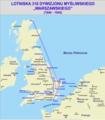
Polskie dywizjony lotn anglia.png 1,900 × 2,738; 1.33 MB
-
Pomorze ak brodnica.png 1,856 × 2,852; 1.33 MB
-
Pomorze ak bydgoszcz.png 1,857 × 2,858; 1.35 MB
-
Pomorze ak chojnice.png 1,856 × 2,852; 1.33 MB
-
Pomorze ak gdansk.png 1,808 × 2,876; 1.35 MB
-
Pomorze ak gdynia.png 1,856 × 2,852; 1.32 MB
-
Pomorze ak grudziadz.png 1,856 × 2,852; 1.34 MB
-
Pomorze ak tczew.png 1,856 × 2,852; 1.32 MB
-
Pomorze ak torun.png 1,856 × 2,852; 1.33 MB
-
Pomorze ak wloclawek.png 1,856 × 2,852; 1.34 MB
-
Poznan AK gniezno.png 2,026 × 2,394; 1.27 MB
-
Poznan AK jarocin.png 2,026 × 2,394; 1.29 MB
-
Poznan AK konin.png 2,026 × 2,394; 1.3 MB
-
Poznan AK krotoszyn.png 2,026 × 2,394; 1.3 MB
-
Poznan AK leszno.png 2,026 × 2,394; 1.29 MB
-
Poznan AK ostrow.png 2,026 × 2,394; 1.36 MB
-
Poznan AK poznan.png 2,026 × 2,394; 1.29 MB
-
Poznan AK sroda.png 2,026 × 2,394; 1.29 MB
-
Poznan AK zachod.png 2,026 × 2,394; 1.29 MB


