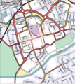
Category:Maps of Chester
Jump to navigation
Jump to search
Wikimedia category | |||||
| Upload media | |||||
| Instance of | |||||
|---|---|---|---|---|---|
| Category combines topics | |||||
| Chester | |||||
city in Cheshire, England | |||||
| Instance of |
| ||||
| Location | Cheshire West and Chester, Cheshire, North West England, England | ||||
| Inception |
| ||||
| Significant event |
| ||||
| Population |
| ||||
| Area |
| ||||
| official website | |||||
 | |||||
Media in category "Maps of Chester"
The following 28 files are in this category, out of 28 total.
-
Bridgegate information board - geograph.org.uk - 642745.jpg 480 × 640; 117 KB
-
Chester Rural District, Cheshire (1970).svg 1,410 × 1,018; 385 KB
-
Chester UK ward map 1980.svg 565 × 712; 227 KB
-
Chester UK ward map 1982.svg 565 × 712; 228 KB
-
Chester UK ward map 1983.svg 565 × 712; 227 KB
-
Chester UK ward map 1984.svg 565 × 712; 228 KB
-
Chester UK ward map 1986.svg 565 × 712; 228 KB
-
Chester UK ward map 1987.svg 565 × 712; 228 KB
-
Chester UK ward map 1988.svg 565 × 712; 228 KB
-
Chester UK ward map 1990.svg 565 × 712; 228 KB
-
Chester UK ward map 1991.svg 565 × 712; 228 KB
-
Chester UK ward map 1992.svg 565 × 712; 227 KB
-
Chester UK ward map 1994.svg 565 × 712; 227 KB
-
Chester UK ward map 1995.svg 565 × 712; 227 KB
-
Chester UK ward map 1996.svg 565 × 712; 227 KB
-
Chester UK ward map 1998.svg 565 × 712; 227 KB
-
Chester UK ward map 1999.svg 445 × 560; 403 KB
-
Chester UK ward map 2000.svg 445 × 560; 396 KB
-
Chester UK ward map 2002.svg 445 × 560; 396 KB
-
Chester UK ward map 2003.svg 445 × 560; 396 KB
-
Chester UK ward map 2004.svg 445 × 560; 396 KB
-
Chester UK ward map 2006.svg 445 × 560; 396 KB
-
Chester unparished area UK locator map.svg 1,425 × 1,161; 1.38 MB
-
County Borough of Chester, Cheshire (1970).svg 1,410 × 1,018; 385 KB
-
Location map United Kingdom Chester Central.png 2,115 × 1,888; 1.58 MB
-
Location map United Kingdom Chester city walls.png 876 × 1,187; 805 KB
-
OpenStreetMapCentralChester.png 1,023 × 1,145; 291 KB


