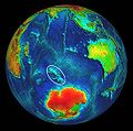
Category:Locator maps of the Kerguelen Islands
Jump to navigation
Jump to search
Media in category "Locator maps of the Kerguelen Islands"
The following 30 files are in this category, out of 30 total.
-
Altazin-pos.png 632 × 600; 148 KB
-
Boynes-pos.png 632 × 600; 148 KB
-
Courbet-pos.png 2,110 × 2,002; 340 KB
-
Gaby-pos.png 632 × 600; 148 KB
-
Grande Terre-pos.png 2,110 × 2,002; 362 KB
-
Ile de l Ouest-pos.PNG 2,110 × 2,002; 340 KB
-
Ile du Port-pos.png 2,110 × 2,002; 340 KB
-
Ile Longue-pos.png 2,110 × 2,002; 340 KB
-
Ile Saint-Lanne Gramont-pos.png 2,110 × 2,002; 340 KB
-
IleAustralia-pos.png 632 × 600; 123 KB
-
IleFoch-pos.png 2,110 × 2,002; 343 KB
-
IleHowe-pos.png 2,110 × 2,002; 340 KB
-
IlePrinceMonaco-pos.png 2,110 × 2,002; 343 KB
-
Kerguelen BaieNorvegienne.PNG 2,110 × 2,002; 341 KB
-
Kerguelen GolfeBaleiniers.PNG 2,110 × 2,002; 332 KB
-
Kerguelen GolfeMorbihan.PNG 2,110 × 2,002; 342 KB
-
Kerguelen Plateau Location.jpg 548 × 545; 123 KB
-
Kerguelen-Location.JPG 872 × 872; 119 KB
-
Kerguelen-pos mk.png 5,613 × 5,783; 1.15 MB
-
Kerguelen-pos.jpg 1,485 × 1,530; 170 KB
-
Kerguelen-pos.png 1,485 × 1,530; 121 KB
-
Kerguelen-position.png 782 × 385; 21 KB
-
MontRoss-pos.png 649 × 589; 60 KB
-
Nuageuses-Kerguelen.png 2,110 × 2,002; 341 KB
-
Orthographic projection centred over Kerguelen Island.png 488 × 487; 21 KB
-
Port-aux-Francais-pos.png 2,110 × 2,002; 343 KB
-
Presqu'île ronarc'h-pos.png 632 × 600; 147 KB
-
PrqSocdeGeo-pos.png 2,110 × 2,002; 344 KB
-
Île de Croÿ locator map.svg 1,840 × 1,915; 519 KB
-
Île-haute-kerguelen.png 2,110 × 2,002; 155 KB


