
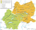
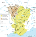
Category:Kingdom of Burgundy
English: Kingdom of Burgundy was a medieval kingdom, centered in the historic region of Burgundy, in Western Europe. It existed as a political entity in a number of forms, with very different boundaries. The first was an early medieval Kingdom of the Burgundians in the 5th and the 6th century. The second was the Kingdom of Lower Burgundy, and also the Kingdom of Upper Burgundy in the 9th and the 10th century. The third was a later medieval Kingdom of Burgundy, also known as the Kingdom of Arles, that existed from the 11th to the 15th century, when it was dissolved. A fourth was very nearly created by merging the County of Burgundy with the Duchy of Burgundy in the late 15th century. During the early modern period, royal traditions of the former Burgundian kingdoms were continued and reflected within the grand title of Holy Roman Emperors.
Français : Un royaume de Bourgogne, la Burgondie, fut créé par le peuple burgonde après son installation sur les bords du lac Léman, en Sapaudie, au . Son souverain le plus glorieux, Gondebaud, gouverna alors un territoire qui s'étend de Langres à Marseille et du Rhin à la Loire.
history of all the kingdoms and others states named Burgundy .svg)  | |||||
| Upload media | |||||
| Instance of | |||||
|---|---|---|---|---|---|
| Basic form of government | |||||
| Official language | |||||
| Has part(s) |
| ||||
| Different from | |||||
| |||||
Subcategories
This category has the following 3 subcategories, out of 3 total.
Media in category "Kingdom of Burgundy"
The following 57 files are in this category, out of 57 total.
-

-
 Bourgogne 843.png 1,024 × 1,043; 450 KB
-
 Karte Koenigreich Burgund 2 DE.png 1,500 × 1,529; 202 KB
-
 Les 4 commendement de bourgognes.png 1,024 × 1,044; 378 KB
-
 Map Burgundian Kingdom 2 EN.png 1,500 × 1,529; 204 KB
-
 Map Burgundian Kingdom 2 hu.svg 2,000 × 2,039; 370 KB
-
 Map Burgundian Kingdom-es.svg 1,002 × 1,014; 245 KB
-
 Map Burgundian Kingdom-hu.svg 1,002 × 1,014; 237 KB
-
 Map Burgundian Kingdom.svg 1,002 × 1,014; 236 KB
-
 Deling Prüm 855.png 512 × 464; 24 KB
-
 AltaYBajaBorgoñaSiglosIXX.svg 1,002 × 1,014; 1.17 MB
-
 Karte Hoch Niederburgund-FR.png 2,000 × 2,126; 549 KB
-
 Karte Hoch und Niederburgund EN.png 2,000 × 2,126; 538 KB
-
 Karte Hoch und Niederburgund-el.png 1,310 × 1,338; 200 KB
-
 Karte Hoch- und Niederburgund.png 2,000 × 2,126; 549 KB
-
 Alamannien Hochburgund ca 1000.png 2,500 × 2,107; 1.11 MB
-
 Alamannien.svg 397 × 350; 734 KB
-
 Droysens-21c.jpg 2,152 × 2,764; 4.16 MB
-
 Souabe et Haute-Bourgogne.png 2,500 × 2,107; 1.12 MB
-
 Souabe et Haute-Bourgogne1.png 1,500 × 1,352; 407 KB
-
 Vertrag von Verdun und Ribemont ru.svg 890 × 890; 698 KB
-
 Vertrag von Verdun und Ribemont-es.svg 890 × 890; 1.01 MB
-
 Vertrag von Verdun und Ribemont.svg 890 × 890; 696 KB
-
 Kingdom of Arles 1000.svg 485 × 340; 1.25 MB
-
 Lorraine 1000.png 488 × 572; 634 KB
-
 BorgoñaSiglosXIIXIII.svg 1,068 × 1,081; 1.3 MB
-
 Carte-Royaume-dArles.png 1,500 × 1,529; 412 KB
-
 Karte Königreich Arelat DE.png 1,500 × 1,529; 414 KB
-
 Map Kingdom Arelat AR.png 1,454 × 1,485; 856 KB
-
 Map Kingdom Arelat EN.png 1,310 × 1,338; 209 KB
-
 Map Kingdom Arelat-el.png 1,310 × 1,338; 227 KB
-
 La Bourgogne aux XI et XIIe siècles.svg 1,050 × 1,450; 302 KB
-
 Arelat New.png 674 × 920; 189 KB
-
 Map of kingdom of Arles-es.svg 5,382 × 7,087; 1.74 MB
-
 Map of kingdom of Arles.jpg 500 × 659; 112 KB
-
 Lower Burgundy 1200.png 524 × 577; 99 KB
-
 C. 1250 Holy Roman Empire (Southwestern region).jpg 1,032 × 1,129; 1.28 MB
-
 C. 1250 Savoy, the Dauphiné and Provence.jpg 776 × 732; 693 KB
-
 Armes du Royaume d'Arles.svg 600 × 685; 207 KB
-
 Banner of arms of the kingdom of Arles.png 1,775 × 1,775; 25 KB
-
 Burgundy kings.png 842 × 595; 31 KB
-
 Denier of Conrad the Peaceful.jpg 590 × 589; 145 KB
-
 Denier of Conrad the Peaceful.webp 800 × 381; 94 KB
-
 Karte Koenigreich Burgund DE.png 1,500 × 1,529; 405 KB
-
 Le royaume des Francs sous Hugues Capet-be.svg 1,796 × 1,796; 1.36 MB
-
 Le royaume des Francs sous Hugues Capet-en.svg 1,796 × 1,796; 1.37 MB
-
 Le royaume des Francs sous Hugues Capet-es.svg 1,916 × 1,916; 1.37 MB
-
 Le royaume des Francs sous Hugues Capet-fr.svg 1,796 × 1,796; 1.38 MB
-
 Le royaume des Francs sous Hugues Capet-ka.svg 1,796 × 1,800; 1.23 MB
-
 Le royaume des Francs sous Hugues Capet-ru.svg 1,796 × 1,796; 1.07 MB
-
 Les pagi de la Bourgogne Viennoise au VIIIe et IXe siècle.gif 972 × 972; 210 KB
-
 Map Burgundia 443-476-hu.svg 1,068 × 1,081; 366 KB
-
 Map Burgundian Kingdom EN.png 1,500 × 1,529; 242 KB
-
 Map Burgundian Kingdom-el.png 1,500 × 1,529; 317 KB
-
 Map Burgundian Kingdom443-476-es.svg 1,068 × 1,081; 1.14 MB
-
 Map Burgundian Kingdom443-476-ru.svg 1,067 × 1,082; 361 KB
-
 Premier royaume de bourgogne.png 741 × 786; 189 KB


.jpg)


