Category:English-language SVG maps of Africa
Jump to navigation
Jump to search
Media in category "English-language SVG maps of Africa"
The following 90 files are in this category, out of 90 total.
-
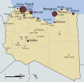
20111009144259!2011 Battle of Sirte.svg 1,165 × 674; 50 KB
-
2014 ebola virus epidemic in West Africa.svg 1,600 × 850; 384 KB
-
Africa HSR 2063 (1).svg 512 × 523; 820 KB
-
Africa map of Köppen climate classification.svg 1,900 × 1,900; 899 KB
-
Africa Precipitation Map.svg 1,000 × 1,000; 458 KB
-
African continent-en.svg 1,525 × 1,440; 752 KB
-
African continent-nb en.svg 1,390 × 1,295; 617 KB
-
African continent20100726-en.svg 1,525 × 1,440; 750 KB
-
African language families en.svg 600 × 650; 53 KB
-
Afrodias logo.svg 97 × 110; 61 KB
-
Alaouite dynasty of Morocco-ar.svg 385 × 408; 938 KB
-
Alaouite dynasty of Morocco-en.svg 385 × 408; 945 KB
-
Alawi sultanate per Atlas of Islamic History.svg 411 × 436; 846 KB
-
Algeria map of Köppen climate classification.svg 1,900 × 1,900; 125 KB
-
Almohad dynasty of Morocco-en.svg 557 × 409; 1.01 MB
-
Almoravid dynasty of Morocco-en.svg 362 × 457; 943 KB
-
Angola map of Köppen climate classification.svg 1,900 × 1,900; 131 KB
-
Benin map of Köppen climate classification.svg 1,900 × 1,900; 62 KB
-
Biafra independent state map-en.svg 1,100 × 850; 472 KB
-
Botswana map of Köppen climate classification.svg 1,900 × 1,900; 55 KB
-
Burkina Faso map of Köppen climate classification.svg 1,900 × 1,510; 58 KB
-
Cabinda map-en.svg 977 × 1,290; 137 KB
-
Cameroon map of Köppen climate classification.svg 1,900 × 1,900; 102 KB
-
Cape to Cairo.svg 720 × 780; 65 KB
-
Carte des routes d'immigration africaine vers l'Europe en.svg 729 × 609; 71 KB
-
Central African Republic map of Köppen climate classification.svg 1,900 × 1,375; 80 KB
-
Chad map of Köppen climate classification.svg 1,900 × 1,900; 82 KB
-
Côte d’Ivoire map of Köppen climate classification.svg 1,900 × 1,900; 68 KB
-
Democratic Republic of the Congo map of Köppen climate classification.svg 1,900 × 1,900; 139 KB
-
Districts of Botswana en.svg 2,000 × 2,122; 69 KB
-
Eritrea map of Köppen climate classification.svg 1,900 × 1,900; 66 KB
-
Eritrean Railway Map of March, 1998.svg 1,660 × 800; 15 KB
-
Ethiopia map of Köppen climate classification.svg 2,027 × 2,027; 236 KB
-
Expansion of Afroasiatic.svg 793 × 802; 370 KB
-
Fgm map.svg 640 × 612; 176 KB
-
Gabon map of Köppen climate classification.svg 1,900 × 1,900; 61 KB
-
Gas pipelines across Mediterranee and Sahara map-en.svg 832 × 1,573; 3.8 MB
-
Ghana map of Köppen climate classification.svg 1,900 × 1,900; 58 KB
-
Guniea map of Köppen climate classification.svg 1,900 × 1,510; 65 KB
-
Hassaniya Arabic Map.svg 285 × 227; 59 KB
-
Languages of Africa map.svg 1,534 × 1,461; 750 KB
-
Languages speakers in Morocco.svg 596 × 453; 130 KB
-
Libya map of Köppen climate classification.svg 1,900 × 1,900; 119 KB
-
Libya-kart3.svg 1,190 × 1,271; 46 KB
-
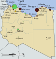
Libyan Uprising - Gulf of Sidra.svg 900 × 420; 140 KB
-
Libyan Uprising scratchmap.svg 339 × 354; 260 KB
-
Libyan Uprising(2011-03-06).svg 690 × 715; 51 KB
-
Libyan Uprising(2011-03-08).svg 339 × 354; 33 KB
-
Libyan Uprising.svg 735 × 715; 60 KB
-
Libyan war final.svg 1,100 × 1,100; 97 KB
-
Madagascar map of Köppen climate classification.svg 1,900 × 1,900; 184 KB
-
Mali map of Köppen climate classification.svg 1,900 × 1,900; 87 KB
-
Mantella baroni map.svg 545 × 533; 495 KB
-
Map of African language families.svg 1,525 × 1,440; 1.05 MB
-
Map of Malagasy language dialects.svg 746 × 785; 1.49 MB
-
Map of religious orders (tariqas) in the Alawi Sultanate.svg 411 × 436; 628 KB
-
Map of South Africa.svg 1,000 × 1,000; 475 KB
-
Map of the Atlantic–Congo languages.svg 1,342 × 1,123; 1.07 MB
-
Map of the Bantoid languages.svg 1,342 × 1,123; 1.06 MB
-
Map of the Bantu languages.svg 1,342 × 1,123; 1.08 MB
-
Map of the Niger–Congo languages.svg 1,342 × 1,123; 1.09 MB
-
Map of the Southern Bantoid languages.svg 1,342 × 1,123; 1.07 MB
-
Map of the Volta–Congo languages.svg 1,342 × 1,123; 1.07 MB
-
Map of Zanzibar Archipelago-en.svg 628 × 794; 817 KB
-
Map of zones of Ethiopia numbers.svg 1,843 × 1,494; 943 KB
-
Map of zones of Ethiopia.svg 1,843 × 1,494; 1.1 MB
-
Morocco map of Köppen climate classification.svg 1,900 × 1,652; 96 KB
-
Morocco regions Amazigh languages speakers.svg 596 × 629; 191 KB
-
Mozambique map of Köppen climate classification.svg 1,900 × 1,900; 153 KB
-
Namibia map of Köppen climate classification.svg 1,900 × 1,900; 74 KB
-
Sudan map of Köppen climate classification.svg 1,900 × 1,900; 93 KB
-
Tanzania map of Köppen climate classification.svg 1,900 × 1,900; 203 KB
-
Tripolitanian Front 1 Mar 2011 01.54.svg 1,453 × 773; 485 KB
-
Tripolitanian Front 11 Aug 2011 23.10.svg 3,400 × 1,400; 211 KB
-
Tripolitanian Front 18 Aug 2011 13.28.svg 3,400 × 1,400; 216 KB
-
Tripolitanian Front 2011-08-29T10-29-59.svg 3,400 × 1,400; 231 KB
-
Tripolitanian Front 29 Mar 2011 13.37.svg 1,764 × 744; 398 KB
-
Tripolitanian Front-final.svg 3,400 × 1,400; 249 KB
-
Tripolitanian Front.svg 3,400 × 1,400; 222 KB
-
Tunisia map of Köppen climate classification.svg 1,900 × 1,900; 117 KB
-
Uganda map of Köppen climate classification.svg 1,900 × 1,900; 94 KB
-
West African Basins.svg 614 × 468; 100 KB
-
West African Craton.svg 361 × 357; 165 KB
-
Western Cape topography labelled (with provincial labels).svg 1,584 × 1,262; 3.81 MB
-
Western Cape topography labelled.svg 1,584 × 1,262; 3.78 MB
-
Western sahara walls moroccan map-en.svg 1,676 × 1,302; 210 KB
-
Western-sahara-map.svg 1,450 × 1,734; 818 KB
-
Westhoek map-en.svg 1,200 × 800; 714 KB
-
Zambia map of Köppen climate classification.svg 1,900 × 1,900; 121 KB
-
Zimbabwe map of Köppen climate classification.svg 1,900 × 1,900; 121 KB


