Category:Cumwhinton
Jump to navigation
Jump to search
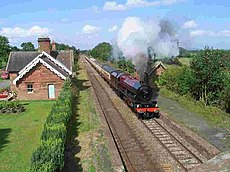
English: Cumwhinton is a small village close to Carlisle England, around one mile away from both Scotby and Wetheral. The village lies in Wetheral civil parish
village in Cumbria, United Kingdom | |||||
| Upload media | |||||
| Instance of | |||||
|---|---|---|---|---|---|
| Location | Wetheral, Carlisle, Cumbria, North West England, England | ||||
 | |||||
Subcategories
This category has the following 2 subcategories, out of 2 total.
C
- Cumwhinton War Memorial (1 F)
Media in category "Cumwhinton"
The following 21 files are in this category, out of 21 total.
-
Cumwhinton, Cumbria (2129586900).jpg 1,280 × 960; 174 KB
-
Eden Bank - geograph.org.uk - 357132.jpg 640 × 427; 103 KB
-
Lowther Arms, Cumwhinton - geograph.org.uk - 265616.jpg 640 × 480; 85 KB
-
Old chapel, Cumwhinton - geograph.org.uk - 2136198.jpg 640 × 480; 279 KB
-
Road sign, Cumwhinton - geograph.org.uk - 4314480.jpg 800 × 600; 471 KB
-
A6 - geograph.org.uk - 283470.jpg 640 × 480; 65 KB
-
Bridleway bridge - geograph.org.uk - 445540.jpg 640 × 480; 131 KB
-
Cumwhinton Primary School - geograph.org.uk - 277832.jpg 640 × 480; 230 KB
-
Double Gates - geograph.org.uk - 277833.jpg 640 × 480; 229 KB
-
Entrance to the R Dixon Group - geograph.org.uk - 283474.jpg 640 × 480; 224 KB
-
Farmland near Cotehill - geograph.org.uk - 195893.jpg 640 × 478; 106 KB
-
Farmland near Wreay - geograph.org.uk - 196340.jpg 640 × 478; 122 KB
-
Farmland, Cotehill - geograph.org.uk - 196350.jpg 640 × 478; 148 KB
-
Footpath to Wetheral Pastures - geograph.org.uk - 446371.jpg 640 × 480; 168 KB
-
Footpath to Wetheral Shield - geograph.org.uk - 283477.jpg 640 × 480; 172 KB
-
The Road to Myre Bank - geograph.org.uk - 283749.jpg 640 × 480; 89 KB
-
The Road to Wragmire Farm - geograph.org.uk - 283472.jpg 640 × 480; 172 KB
-
Wreay Woods - geograph.org.uk - 196329.jpg 478 × 640; 269 KB
-
Wreay Woods - geograph.org.uk - 196336.jpg 478 × 640; 180 KB


