Category:1900s maps of France
Jump to navigation
Jump to search
Subcategories
This category has the following 13 subcategories, out of 13 total.
Media in category "1900s maps of France"
The following 17 files are in this category, out of 17 total.
-
Anjouan Map 1930.jpg 1,942 × 1,208; 1.32 MB
-
Bouguignons.PNG 516 × 744; 873 KB
-
Chandernaggar-Calcuta Map 1900.jpg 1,031 × 2,052; 744 KB
-
GrandeComore Map 1930.jpg 1,192 × 1,900; 1.37 MB
-
Karikal FrIndia Map 1900.jpg 1,288 × 1,147; 605 KB
-
Mahe FrIndia Map 1900.jpg 910 × 877; 377 KB
-
Mayotte Map 1930.jpg 1,250 × 1,956; 1.4 MB
-
Pondicherry Map 1900.jpg 1,645 × 1,937; 1.4 MB
-
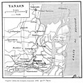
Yanaon Map 1900.jpg 1,424 × 1,428; 877 KB


