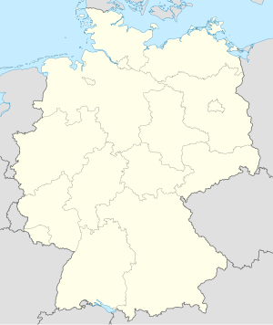
Landkreis Kulmbach
Paghimo ni bot Lsjbot. |
| Landkreis Kulmbach | ||
| Distrito | ||
|
||
| Nasod | ||
|---|---|---|
| Estado pederal | Bavaria | |
| Distrito nga gobyerno | Upper Franconia | |
| Gitas-on | 391 m (1,283 ft) | |
| Tiganos | 50°06′33″N 11°29′58″E / 50.10917°N 11.49944°E | |
| Area | 656.00 km2 (253 sq mi) | |
| Population | 73,211 (2014-01-03) [1] | |
| Density | 112 / km2 (290 / sq mi) | |
| Timezone | CET (UTC+1) | |
| - summer (DST) | CEST (UTC+2) | |
| GeoNames | 3220851 | |
Distrito ang Landkreis Kulmbach sa Alemanya.[1] Nahimutang ni sa distrito nga gobyerno sa Upper Franconia ug estado pederal sa Bavaria, sa sentro nga bahin sa nasod, 300 km sa habagatan sa Berlin ang ulohan sa nasod. Adunay 73,211 ka molupyo.[1] Naglangkob kin og 656 ka kilometro kwadrado. Landkreis Kulmbach mopakigbahin sa usa ka utlanan sa Landkreis Hof, Landkreis Kronach, Landkreis Lichtenfels, ug Landkreis Bayreuth.
Ang yuta sa Landkreis Kulmbach medyo bungtoron.[saysay 1]
Landkreis Kulmbach may sa mosunod nga mga subdibisyon:
- Kulmbach
- Kupferberg
- Stadtsteinach
- Wonsees
- Wirsberg
- Thurnau
- Presseck
- Marktschorgast
- Marktleugast
- Mainleus
- Ludwigschorgast
- Kasendorf
- Grafengehaig
- Untersteinach
- Trebgast
- Rugendorf
- Neuenmarkt
- Neudrossenfeld
- Ködnitz
- Himmelkron
- Harsdorf
- Guttenberg
Hapit nalukop sa kaumahan ang palibot sa Landkreis Kulmbach.[3] Dunay mga 120 ka tawo kada kilometro kwadrado sa palibot sa Landkreis Kulmbach medyo hilabihan populasyon.[4] Ang klima hemiboreal.[5] Ang kasarangang giiniton 7 °C. Ang kinainitan nga bulan Hulyo, sa 19 °C, ug ang kinabugnawan Enero, sa −7 °C.[6]
| ||||||||||||||||||||||||||||||||||||||||||||||||||||||||||||||||||||||||||||||||||||||||||||||||||||||||||||||||||||||||||||
Saysay
[usba | usba ang wikitext]- ↑ Kalkulado gikan sa gitas-on data (DEM 3") gikan sa Viewfinder Panoramas.[2] Ang bug-os nga algoritmo anaa dinhi.
Ang mga gi basihan niini
[usba | usba ang wikitext]- ↑ 1.0 1.1 1.2 Landkreis Kulmbach sa GeoNames.Org (cc-by); post updated 2014-01-03; database download sa 2015-05-23
- ↑ "Viewfinder Panoramas Digital elevation Model". 2015-06-21.
- ↑ "NASA Earth Observations: Land Cover Classification". NASA/MODIS. Retrieved 30 Enero 2016.
- ↑ "NASA Earth Observations: Population Density". NASA/SEDAC. Retrieved 30 Enero 2016.
- ↑ Peel, M C; Finlayson, B L. "Updated world map of the Köppen-Geiger climate classification". Hydrology and Earth System Sciences. 11: 1633–1644. doi:10.5194/hess-11-1633-2007. Retrieved 30 Enero 2016.
{{cite journal}}: CS1 maint: unflagged free DOI (link) - ↑ 6.0 6.1 "NASA Earth Observations Data Set Index". NASA. Retrieved 30 Enero 2016.
Gikan sa gawas nga tinubdan
[usba | usba ang wikitext]| Aduna'y mga payl ang Wikimedia Commons nga may kalabotan sa artikulong: Landkreis Kulmbach. |


