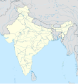
ไฟล์:India location map.svg

ขนาดของตัวอย่าง PNG นี้ของไฟล์ SVG นี้: 557 × 600 พิกเซล ความละเอียดอื่น: 223 × 240 พิกเซล | 446 × 480 พิกเซล | 713 × 768 พิกเซล | 951 × 1,024 พิกเซล | 1,902 × 2,048 พิกเซล | 1,500 × 1,615 พิกเซล
ดูภาพที่มีความละเอียดสูงกว่า ((ไฟล์ SVG, 1,500 × 1,615 พิกเซล, ขนาดไฟล์: 1.23 เมกะไบต์))
ประวัติไฟล์
คลิกวันที่/เวลาเพื่อดูไฟล์ที่ปรากฏในขณะนั้น
| วันที่/เวลา | รูปย่อ | ขนาด | ผู้ใช้ | ความเห็น | |
|---|---|---|---|---|---|
| 23:10, 18 มกราคม 2554 |  | 1,500 × 1,615 (2.36 เมกะไบต์) | Uwe Dedering | Reverted to version as of 15:50, 17 January 2011 and again, layer structure destroyed, and first discuss this! | |
| 02:04, 18 มกราคม 2554 |  | 1,500 × 1,615 (1.52 เมกะไบต์) | AshwiniKalantri | The disputed land of Kashmir are shown in a different shade. | |
| 22:50, 17 มกราคม 2554 |  | 1,500 × 1,615 (2.36 เมกะไบต์) | Uwe Dedering | Reverted to version as of 11:34, 22 September 2010 vandalism | |
| 06:30, 17 มกราคม 2554 |  | 1,500 × 1,615 (2.01 เมกะไบต์) | AshwiniKalantri | {{Information |Description=Location Map of India |Source= |Date= |Author= |Permission= |other_versions= }} | |
| 18:34, 22 กันยายน 2553 |  | 1,500 × 1,615 (2.36 เมกะไบต์) | BishkekRocks | The area north of the Siachen Glacier is also part of Chinese-controlled Kashmir. | |
| 23:36, 31 สิงหาคม 2553 |  | 1,500 × 1,615 (2.3 เมกะไบต์) | Uwe Dedering | Coloured Pakistani-controlled parts of Kashmir in dark grey & Chinese-controlled Kashmir also. no reason to treat them differently. | |
| 18:26, 31 สิงหาคม 2553 |  | 1,500 × 1,615 (2.01 เมกะไบต์) | AnonyLog | A lighter shade is used for uniformity with other maps of India and Pakistan on Wikipedia. | |
| 23:44, 5 พฤษภาคม 2553 |  | 1,500 × 1,615 (2.3 เมกะไบต์) | Uwe Dedering | Reverted to version as of 12:26, 3 March 2010 make them dark-grey if you wish.... | |
| 22:43, 5 พฤษภาคม 2553 |  | 1,500 × 1,615 (2.01 เมกะไบต์) | BishkekRocks | Coloured Pakistani-controlled parts of Kashmir in light grey (like Chinese-controlled Kashmir). Alternatively colour both in dark grey, no reason to treat them differently. | |
| 19:26, 3 มีนาคม 2553 |  | 1,500 × 1,615 (2.3 เมกะไบต์) | Uwe Dedering | {{Information |Description={{en|Location map of India. Equirectangular projection. Strechted by 106.0%. Geographic limits of the map: * N: 37.5° N * S: 5.0° N * W: 67.0° E * E: 99.0° E Made with Natural Earth. Free vector and raster map data @ natural |
หน้าที่มีภาพนี้
มีหน้าที่ใช้ไฟล์นี้มากกว่า 100 หน้า รายการต่อไปนี้แสดงหน้าที่ใช้ไฟล์นี้ 100 หน้าแรกเท่านั้น มีรายการเต็ม
- กลุ่มสถาบันวิทยาศาสตร์การแพทย์ออลล์อินเดีย
- กังต็อก
- กุตุบมีนาร์
- ขรรคปุระ
- ขัณฑวา
- คลื่นความร้อนในประเทศอินเดีย พ.ศ. 2558
- คลื่นความร้อนในประเทศอินเดียและปากีสถาน พ.ศ. 2562
- คาซีปุระ
- คานธีนคร
- คุรุคราม
- จันทนนคร
- จันทนีจาวก์
- จารธาม
- ชลันธร (เมือง)
- ชัมเศทปุระ
- ชูนาครห์
- ชโยติรลึงค์
- ดาร์จีลิง
- ดีอีแอลโฟร์ตีเอต
- ตฤศศูร
- ติรุวนันตปุรัม
- ถ้ำเอลโลรา
- ทรภังคา
- ทัชมาฮาล
- ท่าอากาศยานนานาชาติกาลีกัต
- ท่าอากาศยานนานาชาติศรีคุรุรามทาสจี
- ท่าอากาศยานนานาชาติสรทาร วัลลภภาอี ปเฏล
- ท่าอากาศยานนานาชาติเกมเปโควทา
- ท่าอากาศยานนานาชาติเจนไน
- ธัมเมกขสถูป
- นอยดา
- นิวเดลี
- บานดรา
- ปฏิอาลา
- ปณชี
- ปัญจตัขต์
- ปุรี
- พิกาเนร์
- พุทธคยา
- ฟุตบอลโลก รุ่นอายุไม่เกิน 17 ปี 2017
- ภุพเนศวร
- มตุไร
- มะจิลีปัตนัม
- มัสยิดบาบรี
- มุมไบ
- รถด่วนดุรนตุ
- รถด่วนราชธานี
- รังกนาตจุวามิโกยิล (ติรุวรังกัม)
- รามมนเทียร
- รายชื่อแหล่งมรดกโลกในประเทศอินเดีย
- รายปุระ
- ฤษีเกศ
- ลุธิอาณา
- วฤนทาวัน
- วัดกยองคำ
- วารลี
- วิศาขาปัฏฏนัม
- ศรวัณเพลโคละ
- สถานีปลายทางฉัตรปตีศิวาจี
- สถาบันเทคโนโลยีแห่งอินเดีย
- สวนพุทธสมฤติ
- สังกัสสะ
- หมู่ถ้ำเอลิฟันตา
- หมู่บ้านปิปราห์วา
- หริทวาร
- หริมันทิรสาหิบ
- อกาลตาคัต
- อนุสรณ์สถานหินวิเวกานันท์
- อมรนาถมนเทียร
- อมราวตี (รัฐมหาราษฏระ)
- อลาหาบาด
- อลีครห์
- อัครตละ
- อาครา
- อานันทปุรสาหิบ
- อำเภอมุมไบซิตี
- อินเดียนพรีเมียร์ลีก
- อุทัยปุระ
- อูนะโกฏิ
- เจาขัณฑีสถูป
- เดห์ราดูน
- เบงคลูรู
- เลห์
- เหตุการณ์การทำลายมัสยิดบาบรี
- เหตุเครื่องบินชนกันกลางอากาศที่จรรขีทาทรี พ.ศ. 2539
- เอารังคาบาด
- เอเชียนเกมส์ 1951
- โกจจิ
- โกณารักสูรยมนเทียร
- โกลกาตา
- โกหิมา
- โกฬิกโกฏ
- โครัขปุระ
- โชธปุระ
- โภปาล
- โอรฉะ
- ไกรลาศมนเทียร (เอลโลรา)
- ไอ-ลีก
- แม่แบบ:Location map India
- แม่แบบ:Location map India airport
ดูการเชื่อมโยงมายังไฟล์นี้เพิ่มเติม
การใช้ไฟล์ข้ามโครงการ
วิกิอื่นต่อไปนี้ใช้ไฟล์นี้:
- การใช้บน ace.wikipedia.org
- การใช้บน af.wikipedia.org
- Leh
- Taj Mahal
- Amritsar
- Sjabloon:Liggingkaart Indië
- Indore
- Thane
- Bhopal
- Visakhapatnam
- Pimpri-Chinchwad
- Vadodara
- Ghaziabad
- Ludhiana
- Nashik
- Faridabad
- Meerut
- Rajkot
- Kalyan-Dombivali
- Vasai-Virar
- Srinagar
- Aurangabad
- Dhanbad
- Navi Mumbai
- Prayagraj
- Ranchi
- Haora
- Coimbatore
- Jabalpur
- Gwalior
- Vijayawada
- Jodhpur
- Madurai
- Raipur
- Kota
- Guwahati
- Chandigarh
- Solapur
- Hubli-Dharwad
- Indiese nasionale krieketspan
- Tiruchirappalli
- Thiruvananthapuram
- Krieketwêreldbeker 1987
- Krieketwêreldbeker 1996
- Krieketwêreldbeker 2011
- Krieketwêreldbeker 2023
- Jaynagar Majilpur
- Wes-Ghats
- Kushok Bakula Rimpochee Lughawe
ดูการใช้ข้ามโครงการเพิ่มเติมของไฟล์นี้


