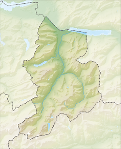
Elm, Switzerland
Appearance
Elm | |
|---|---|
| Coordinates: 46°55′N 9°10′E / 46.917°N 9.167°E | |
| Country | Switzerland |
| Canton | Glarus |
| District | n.a. |
| Area | |
| • Total | 90.73 km2 (35.03 sq mi) |
| Elevation | 977 m (3,205 ft) |
| Population (December 2003) | |
| • Total | 741 |
| • Density | 8.2/km2 (21/sq mi) |
| Time zone | UTC+01:00 (Central European Time) |
| • Summer (DST) | UTC+02:00 (Central European Summer Time) |
| Postal code(s) | 8767 |
| SFOS number | 1605 |
| Localities | Müsli, Obmoos, Schwändi, Steinibach, Sulzbach, Töniberg, Untertal, Vogelsang, Wald |
| Surrounded by | Andiast (GR), Betschwanden, Flims (GR), Laax (GR), Linthal, Luchsingen, Matt, Mels (SG), Pfäfers (SG), Pigniu (GR), Ruschein (GR), Schwanden, Siat (GR) |
| Website | www SFSO statistics |
Elm was a municipality, in the municipality of Glarus Süd and canton of Glarus in Switzerland.
It is the municipality farthest south in the valley of the Sernf.

History
[change | change source]Russian General Alexander Suvarov and his troops stayed the night in Elm before crossing Panix Pass to Pigniu on their retreat into Austria.
On September 11, 1881, an avalanche caused by too much mining of slate killed 114 people and buried 83 structures in the municipality.
Other websites
[change | change source]![]() Media related to Elm at Wikimedia Commons
Media related to Elm at Wikimedia Commons
- Website of the touristic region of Elm (in German)


