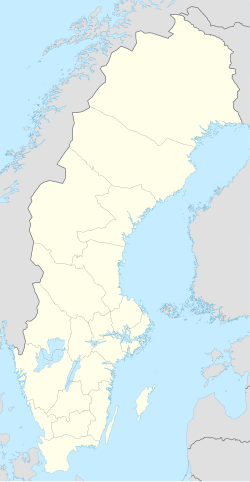
Kosta, Sweden
Appearance
Kosta | |
|---|---|
 Kosta glassworks, 1890s | |
| Coordinates: 56°51′N 15°23′E / 56.850°N 15.383°E | |
| Country | Sweden |
| Province | Småland |
| County | Kronoberg County |
| Municipality | Lessebo Municipality |
| Area | |
| • Total | 1.62 km2 (0.63 sq mi) |
| Population (31 December 2010)[1] | |
| • Total | 884 |
| • Density | 547/km2 (1,420/sq mi) |
| Time zone | UTC+1 (CET) |
| • Summer (DST) | UTC+2 (CEST) |
Kosta (Swedish pronunciation: [ˈkûːsta])[2] is a locality situated in Lessebo Municipality, Kronoberg County, Sweden with 884 inhabitants in 2010.[1]
It is located between the cities of Kalmar and Växjö, in the forested Småland province.
Kosta is known for the glassworks, Kosta Boda.
Climate
[edit]| Climate data for Kosta Swedish Armed Forces Weather station, 1961-2020 | |||||||||||||
|---|---|---|---|---|---|---|---|---|---|---|---|---|---|
| Month | Jan | Feb | Mar | Apr | May | Jun | Jul | Aug | Sep | Oct | Nov | Dec | Year |
| Mean daily maximum °C (°F) | −1.1 (30.0) |
−0.4 (31.3) |
4.2 (39.6) |
10.0 (50.0) |
15.8 (60.4) |
19.0 (66.2) |
20.0 (68.0) |
19.4 (66.9) |
14.7 (58.5) |
10.2 (50.4) |
4.4 (39.9) |
1.0 (33.8) |
9.8 (49.6) |
| Daily mean °C (°F) | −3.4 (25.9) |
−3.4 (25.9) |
−0.4 (31.3) |
4.0 (39.2) |
9.8 (49.6) |
14.0 (57.2) |
15.2 (59.4) |
14.5 (58.1) |
10.6 (51.1) |
6.5 (43.7) |
1.8 (35.2) |
−1.8 (28.8) |
5.6 (42.1) |
| Mean daily minimum °C (°F) | −6.0 (21.2) |
−6.4 (20.5) |
−5.0 (23.0) |
−1.9 (28.6) |
3.7 (38.7) |
9.0 (48.2) |
10.0 (50.0) |
9.6 (49.3) |
5.5 (41.9) |
2.8 (37.0) |
−0.6 (30.9) |
−4.5 (23.9) |
1.3 (34.4) |
| Source: [3] | |||||||||||||
References
[edit]- ^ a b c "Tätorternas landareal, folkmängd och invånare per km2 2005 och 2010" (in Swedish). Statistics Sweden. 14 December 2011. Archived from the original on 27 January 2012. Retrieved 10 January 2012.
- ^ Jöran Sahlgren; Gösta Bergman (1979). Svenska ortnamn med uttalsuppgifter (in Swedish). p. 14.
- ^ "SMHI". Archived from the original on 2013-02-13.


