Category:Maps of Shida Kartli
Jump to navigation
Jump to search
Wikimedia category | |||||
| Upload media | |||||
| Instance of | |||||
|---|---|---|---|---|---|
| Category combines topics | |||||
| Shida Kartli | |||||
region in Georgia | |||||
| Instance of | |||||
| Location |
| ||||
| Capital | |||||
| Official language | |||||
| Head of government | |||||
| Inception |
| ||||
| Population |
| ||||
| Area |
| ||||
| Different from | |||||
| official website | |||||
 | |||||
Subcategories
This category has only the following subcategory.
L
Media in category "Maps of Shida Kartli"
The following 20 files are in this category, out of 20 total.
-
Creation of South Ossetia in 1922.svg 447 × 415; 215 KB
-
Dzama river basin on the Shida Kartli map.svg 710 × 686; 8.25 MB
-
Georgia Shida Kartli map.png 560 × 300; 14 KB
-
Historical Shida Kartli in modern international borders of Georgia.svg 942 × 633; 345 KB
-
Map of Khovle, Georgia.jpg 300 × 300; 25 KB
-
Shida Kartli region in Georgia.svg 1,715 × 913; 229 KB
-
ShidaKartliLocationinGeorgia.svg 774 × 413; 716 KB
-
SK-Gori-ka.svg 390 × 284; 555 KB
-
SK-Java-ka.svg 390 × 284; 552 KB
-
SK-Ka.svg 390 × 284; 549 KB
-
SK-Kareli-ka.svg 390 × 284; 552 KB
-
SK-Kaspi-ka.svg 390 × 284; 553 KB
-
SK-Khashuri-ka.svg 390 × 284; 552 KB
-
SSK-Qareli-ka.svg 337 × 284; 540 KB
-
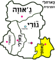
כארתלי הפנימית.png 1,181 × 1,300; 131 KB
-
נפת ג'אווה.PNG 1,181 × 1,300; 133 KB
-
נפת גורי.PNG 1,181 × 1,300; 134 KB
-
נפת חאשורי.PNG 1,181 × 1,300; 132 KB
-
נפת כארלי.PNG 1,181 × 1,300; 133 KB
-
נפת קאספי.PNG 1,181 × 1,300; 132 KB


