Category:German-language SVG maps showing history
Jump to navigation
Jump to search
Subcategories
This category has only the following subcategory.
Media in category "German-language SVG maps showing history"
The following 200 files are in this category, out of 338 total.
(previous page) (next page)-
100 Years War France 1435.svg 948 × 945; 162 KB
-
10May-16May1940-Fall Gelb de.svg 888 × 687; 1.63 MB
-
12 staemme israels.png 2,168 × 3,300; 1.58 MB
-
Kingdom of the Isles, circa 1200 de.svg 384 × 547; 1.22 MB
-
16May-21May1940-Fall Gelb de.svg 889 × 690; 1.73 MB
-
1815-VerenigdKoninkrijkNederlanden-de.svg 742 × 1,042; 624 KB
-
1902 Andes Boundary Case de.svg 537 × 645; 1.02 MB
-
1948 Arab Israeli War - May 15-June 10 de.svg 904 × 884; 344 KB
-
1992ROCLY-cartogram-de.svg 694 × 620; 72 KB
-
1995ROCLY-cartogram-de.svg 693 × 620; 76 KB
-
1998 ROCLY cartogram-de.svg 693 × 620; 87 KB
-
2. Polnische Republik, Woiwodschaften 1931.svg 539 × 595; 190 KB
-
2001 ROCLY cartogram-de.svg 694 × 620; 109 KB
-
2011 Oslo attacks map de.svg 603 × 524; 481 KB
-
21May-4June1940-Fall Gelb de.svg 946 × 732; 2.29 MB
-
Abstimmungsergebnisse Ostpreußen Stimmen 1920.svg 850 × 700; 92 KB
-
Abstimmungsgebiete Ostpreußen Sprachen 1910.svg 850 × 700; 98 KB
-
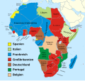
Afrika Karte 1914.svg 1,430 × 1,350; 1.73 MB
-
Alamannien.svg 397 × 350; 734 KB
-
Alliierte Seeoperationen vor Japan im Juli und August 1945.svg 1,418 × 2,017; 379 KB
-
Alsace Lorraine departments evolution map-de.svg 600 × 450; 390 KB
-
Ancient Egypt map-de.svg 1,577 × 3,219; 413 KB
-
AncientGreekDialects (Woodard) de.svg 660 × 555; 852 KB
-
Angelsaksiske-jarldommer de.svg 398 × 475; 14 KB
-
Ansiedlungsrayon.svg 780 × 684; 475 KB
-
Ardennenoffensive (deutsch).svg 557 × 900; 214 KB
-
Assam 1950.svg 703 × 655; 77 KB
-
Asylgesetzinitiative 2016.svg 1,092 × 727; 254 KB
-
Atomausstiegs-Initiative 2016.svg 1,092 × 727; 257 KB
-
Attila in Gaul 451CE-de.svg 1,292 × 989; 553 KB
-
August 2024 Kursk Oblast incursion.svg 1,318 × 930; 1.22 MB
-
Austria Hungary ethnic de.svg 1,360 × 1,052; 1.7 MB
-
Austria-Hungary map de.svg 783 × 605; 572 KB
-
Balkan 1912.svg 966 × 924; 1.35 MB
-
BalticStatesBorders-de.svg 747 × 593; 230 KB
-
Bangladesch Bombenexplosionen JMB 2005.svg 902 × 1,208; 1.75 MB
-
Battle issus decisive-de.svg 738 × 563; 86 KB
-
Battle of Delium general map-de.svg 1,300 × 1,100; 480 KB
-
Belagerung von Cartagena.svg 512 × 658; 131 KB
-
Bergkarabach.svg 900 × 600; 118 KB
-
Bombay 1956-1960 de.svg 893 × 765; 218 KB
-
Britain 802 de.svg 759 × 842; 158 KB
-
British Empire 1938 de.svg 1,372 × 704; 749 KB
-
BritishMandatePalestine1920-de-2.svg 675 × 542; 14 KB
-
BritishMandatePalestine1920-de.svg 675 × 542; 19 KB
-
Bulgaria, after balkan wars 1913 de.svg 1,131 × 904; 2.24 MB
-
Byzantine Constantinople-de.svg 2,606 × 2,361; 853 KB
-
Byzantine Empire Themes 1025-de.svg 1,840 × 1,178; 336 KB
-
Byzantine-Arab naval struggle-de.svg 1,914 × 977; 911 KB
-
Califato de Córdoba - 1000 de.svg 694 × 603; 296 KB
-
Carreira da India de.svg 1,054 × 654; 848 KB
-
Carte Neandertaliens classiques-de.svg 1,069 × 696; 745 KB
-
Caucasus 1213 AD map de.svg 1,155 × 898; 4.5 MB
-
China 1820 de.svg 964 × 732; 403 KB
-
China 1911 de.svg 964 × 732; 460 KB
-
Cnut lands de.svg 642 × 517; 374 KB
-
Conquête de l'Islam à la chute des Omeyyades de.svg 1,221 × 667; 114 KB
-
Corona de Castilla 1400 de.svg 738 × 542; 517 KB
-
Crystal modes multilingual.svg 373 × 1,100; 12 KB
-
Czechoslovakia 1930 linguistic map - de.svg 1,281 × 778; 740 KB
-
Czechoslovakia 1939 de.svg 1,069 × 435; 112 KB
-
Dahala Khagrabari de.svg 695 × 444; 6 KB
-
Departments of French Empire North 1811-de.svg 525 × 775; 52 KB
-
Der Weisse Vogel Flugroute-de.svg 1,422 × 1,437; 61 KB
-
DeutscheLandverluste.svg 730 × 550; 61 KB
-
Deutsches Reich (1871-1918)-de.svg 992 × 917; 1.48 MB
-
Deutsches Reich Preuss.svg 907 × 742; 810 KB
-
Diderot's travel from Paris to Saint Petersburg in 1773-1774 map-de.svg 1,240 × 860; 150 KB
-
Divided Yemen de.svg 1,210 × 730; 44 KB
-
Dutch and Spanish Taiwan de.svg 627 × 720; 175 KB
-
EastJerusalemMap-de.svg 384 × 589; 87 KB
-
Energiestrategie 2050.svg 1,092 × 727; 256 KB
-
England 878 de.svg 988 × 1,229; 1.63 MB
-
England Great Army map de.svg 998 × 1,114; 548 KB
-
Entstehung von Andhra 1953.svg 756 × 716; 211 KB
-
Estland Referendum 2003.svg 707 × 509; 260 KB
-
Europa 1701.svg 1,357 × 1,357; 688 KB
-
Europa 1721.svg 1,357 × 1,357; 680 KB
-
Europa 1789.svg 1,357 × 1,357; 674 KB
-
Europa 1812.svg 1,357 × 1,357; 511 KB
-
Europa 1815.svg 1,340 × 1,363; 554 KB
-
Europa 1861.svg 1,340 × 1,363; 565 KB
-
Europa 1867.svg 1,340 × 1,363; 519 KB
-
Europa 1914.svg 1,363 × 1,363; 353 KB
-
Europa 1929.svg 1,363 × 1,363; 352 KB
-
Fahrt der SMS Emden 1914.svg 1,049 × 1,109; 1.3 MB
-
First Czechoslovak Republic de.SVG 1,001 × 472; 69 KB
-
First Indochina War map 1946 to 1954 de.svg 543 × 771; 1.86 MB
-
First Indochina War map 1950 de.svg 543 × 771; 690 KB
-
First Indochina War map 1954 de.svg 543 × 771; 1.82 MB
-
First Punic War 237 BC de.svg 1,298 × 889; 401 KB
-
France 1552 to 1798-de.svg 2,584 × 1,796; 1.49 MB
-
France Flanders language-de.svg 504 × 346; 119 KB
-
France L-1 (1812)-de.svg 2,250 × 1,750; 1.77 MB
-
Frankish Empire 481 to 814-de.svg 1,735 × 1,227; 332 KB
-
Frankreich 1154-DE.svg 1,405 × 1,675; 676 KB
-
French Mandate for Syria and the Lebanon map de.svg 922 × 762; 140 KB
-
Frieden von Nystad, Stockholm und Fredericksborg.svg 1,127 × 933; 684 KB
-
Frieden von Utrecht und Rastatt.svg 1,042 × 931; 678 KB
-
FristenlösungsInitiative 1977.svg 1,092 × 727; 252 KB
-
Führerhauptquartiere Lage.svg 1,130 × 800; 740 KB
-
Galizien Israeliten 1910.svg 1,075 × 700; 91 KB
-
Gelre overkwartier 1547 de.svg 1,066 × 1,544; 420 KB
-
Gelre overkwartier 1715 de.svg 534 × 757; 518 KB
-
Genghis Khan empire-switch.svg 512 × 331; 275 KB
-
Gengis Khan empire-de.svg 1,025 × 663; 93 KB
-
Germania 70 de.svg 972 × 780; 1.47 MB
-
Gorgan-e-Difar de.svg 1,025 × 652; 183 KB
-
Gotthard-Strassentunnel-Sanierungs-Initiative.svg 1,092 × 727; 255 KB
-
Grundeinkommen-Initiative 2016.svg 1,092 × 727; 255 KB
-
GuerrasBalcánicasLondresYBucarest2 de.svg 965 × 1,455; 1,008 KB
-
GwaliorKart.svg 596 × 565; 57 KB
-
Hannibal route of invasion - de.svg 1,080 × 807; 303 KB
-
Hannibal route of invasion de 2.svg 765 × 520; 654 KB
-
Heiratsstrafen-Initiative 2016.svg 1,092 × 727; 280 KB
-
Hinduism Expansion in Asia de.svg 1,060 × 791; 845 KB
-
Holy Roman Empire 1000 map-de.svg 1,000 × 1,227; 487 KB
-
Homo Sapiens in Europe - solutrean distribution map-de.svg 1,150 × 760; 59 KB
-
TeritorialGainsHungary1920-41 de.svg 836 × 646; 309 KB
-
Ile de France departments 1968 evolution map-de.svg 512 × 640; 362 KB
-
Illyrian Tribes (Deutsch).svg 1,600 × 1,600; 8.57 MB
-
Indian Rashtrakuta Empire map de.svg 1,650 × 1,858; 381 KB
-
Indian revolt of 1857 states map de.svg 990 × 1,115; 610 KB
-
Indien 1951.svg 983 × 1,182; 187 KB
-
Indien 1955.svg 979 × 1,182; 189 KB
-
Indien 1956.svg 985 × 1,185; 307 KB
-
Indien 1959.svg 985 × 1,185; 307 KB
-
Indochina 1954 to 55 map de.svg 543 × 771; 1.9 MB
-
Indochina 1976-1978 map de.svg 1,088 × 1,544; 1.92 MB
-
Indochine francaise de.svg 667 × 1,017; 41 KB
-
IndoreKart.svg 531 × 818; 67 KB
-
Internment at Scapa Flow de.svg 1,314 × 900; 130 KB
-
Israel 850 aC de.svg 617 × 874; 228 KB
-
Italian East Africa (1938–1941) de.svg 1,012 × 908; 37 KB
-
Italien Referendum 1946.svg 850 × 905; 552 KB
-
Italy 1494 de.svg 941 × 1,059; 755 KB
-
Italy 1796 de.svg 896 × 1,060; 1.66 MB
-
Italy 1843 de.svg 924 × 1,075; 1.73 MB
-
Italy 1864 de.svg 924 × 1,065; 1.65 MB
-
Italy 1870 de.svg 924 × 1,065; 1.03 MB
-
Japanese Occupation of China 1940 de.svg 1,119 × 857; 217 KB
-
Jordan frontiers-de.svg 499 × 474; 20 KB
-
Jülich-Kleve-Berg-Erbfolgestreit.svg 831 × 758; 810 KB
-
Kalmar Union c. 1500-de.svg 590 × 685; 285 KB
-
Karte Auschwitz.svg 3,079 × 2,623; 469 KB
-
Karte der Reichstagswahlkreise farbig-2011-11-09.svg 1,164 × 878; 1,020 KB
-
Karte des Alexanderzugs.svg 1,243 × 673; 225 KB
-
Karte Makedonien 336 vC-de.svg 992 × 794; 3.83 MB
-
Karte Markgräflerland.svg 589 × 673; 160 KB
-
Karte Vordere Reichskreise.svg 699 × 684; 210 KB
-
Katyn massacres 1940 map-de.svg 1,053 × 825; 191 KB
-
Kazakhstan 1959 de.svg 1,316 × 739; 31 KB
-
Kingdom of Israel 1020 map-de.svg 2,168 × 3,300; 70 KB
-
Kingdom of Mann and the Isles-de.svg 1,297 × 1,362; 302 KB
-
Kolonialmächte im Pazifikraum, 1939.svg 1,039 × 814; 1.76 MB
-
Kolonien-Afrikas.svg 1,525 × 1,440; 986 KB
-
Kontinentaldrift Indiens.svg 366 × 774; 162 KB
-
Kursk-1943-Plan-GE.svg 2,000 × 2,706; 981 KB
-
Kursk.svg 2,000 × 2,706; 461 KB
-
Königsberg Stadtplan 1905.svg 1,923 × 1,536; 3.28 MB
-
Land boundary agreement map.svg 778 × 539; 76 KB
-
Land boundary agreement map2.svg 484 × 657; 504 KB
-
Laurasia-Gondwana-de.svg 519 × 435; 25 KB
-
Le concile d'Agde en 506 de.svg 755 × 784; 589 KB
-
Le concile d'Orléans en 511 de.svg 680 × 705; 325 KB
-
Leipzig Battle 2 de.svg 1,052 × 744; 199 KB
-
Leipzig Battle de.svg 1,052 × 744; 194 KB
-
Les Francs en Belgique romaine-de.svg 1,280 × 883; 553 KB
-
Les Micmacs (multilingual).svg 3,387 × 2,113; 455 KB
-
LimburgTeilung1839.svg 524 × 765; 79 KB
-
Lithuania territory 1939-1940 de.svg 2,479 × 1,954; 108 KB
-
Lithuanian state in 13-15th centuries-de.svg 729 × 813; 675 KB
-
LithuanianHistory de.svg 1,525 × 1,750; 110 KB
-
Lotharingen-959 de.svg 585 × 752; 320 KB
-
Luxemburg 1659–1839.svg 685 × 715; 32 KB
-
Magna Graecia ancient colonies and dialects-de.svg 440 × 414; 126 KB
-
Majapahit Empire de.svg 512 × 297; 520 KB
-
Malacca Sultanate de.svg 512 × 581; 367 KB
-
Map Almanzor campaigns-de.svg 720 × 571; 101 KB
-
Map Battle of the Nile 1798-de.svg 610 × 880; 828 KB
-
Map Byzantine Empire 1025-de.svg 1,963 × 1,104; 105 KB
-
Map Corded Ware culture-de.svg 1,015 × 598; 662 KB
-
Map Crusader states 1135-de.svg 978 × 1,330; 566 KB
-
Map Crusader states 1135-de2.svg 690 × 738; 563 KB
-
Map Crusader states 1190-de.svg 978 × 1,330; 332 KB
-
Map Crusader states 1240-de.svg 507 × 690; 162 KB
-
Map Europe 1923-de.svg 1,037 × 704; 186 KB
-
Map Europe alliances 1914-de.svg 998 × 593; 124 KB
-
Map France 1180-de.svg 988 × 1,124; 1.94 MB
-
Map Gaul divisions 481-de.svg 755 × 784; 103 KB
-
Map Gaul divisions 511-de.svg 755 × 784; 125 KB
-
Map Hasmonean Kingdom-de.svg 1,571 × 2,000; 409 KB
-
Map Iberian Peninsula 1000-de.svg 827 × 574; 243 KB
-
Map Iberian Peninsula 1030-de.svg 827 × 574; 335 KB
-
Map Kingdom of Holland 1807-de.svg 677 × 611; 159 KB
-
Map Macedonia 336 BC-de.svg 992 × 794; 5.05 MB
-
Map of ancient Epirus and environs (Deutsch).svg 1,422 × 1,614; 1.76 MB
-
Map of Bulgaria after Treaty of Neuilly-sur-Seinе-de.svg 1,134 × 883; 1.76 MB


