Category:19th-century maps of New Zealand
Jump to navigation
Jump to search
Countries of Oceania: Australia · New Zealand · Papua New Guinea · Samoa · Solomon Islands · Vanuatu
Other areas: Hawaii – Partly: Indonesia
Other areas: Hawaii – Partly: Indonesia
Subcategories
This category has the following 7 subcategories, out of 7 total.
.
- 1860s maps of New Zealand (22 F)
- 1870s maps of New Zealand (39 F)
- 1880s maps of New Zealand (18 F)
- 1890s maps of New Zealand (21 F)
Media in category "19th-century maps of New Zealand"
The following 16 files are in this category, out of 16 total.
-
O F Smith Sketch of a strait 1804.tif 636 × 447; 435 KB
-
1818 Pinkerton Map of Australia ^ New Zealand - Geographicus - Australia-pinkerton-1818.jpg 5,000 × 3,652; 2.98 MB
-
Jules Blosseville, Port Pegasus, Stewart Island, New Zealand.tif 2,290 × 1,570; 5.85 MB
-
162 of '(The Story of our Planet ... Illustrated.)' (11245461706).jpg 1,479 × 1,758; 594 KB
-
Broadlands Station and Selwyn River.jpg 2,337 × 1,428; 678 KB
-
Canterbury purchase.jpg 445 × 600; 22 KB
-
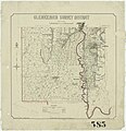
Glenkenich Survey District.jpg 3,732 × 3,854; 3.97 MB
-
Kemps-Deed-Plan-1848-ccc-600x716.jpg 600 × 716; 51 KB
-
Map of Australia, New Zealand, Cook & Friendly Islands (1900) (18288648358).jpg 5,872 × 4,336; 2.26 MB
-
Transactions of the Royal Society of New Zealand (1888) (14597810308).jpg 1,988 × 2,864; 679 KB
-
Transactions of the Royal Society of New Zealand (1888) (14597920107).jpg 2,028 × 3,624; 883 KB
-
Transactions of the Royal Society of New Zealand (1888) (14761435006).jpg 1,992 × 3,460; 880 KB


