The introductions of the country, dependency and region entries are in the native languages and in English. The other introductions are in English.
| |
|
Atlas-country

|
Eswatini
|
|
|
|
|
|
|
|
eSwatini
|
|
|
|
| English
|
Eswatini - Kingdom of Eswatini (formerly Kingdom of Swaziland, officially renamed in 2018)
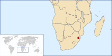
The Kingdom of Eswatini is a small, landlocked country in Southern Africa (the second smallest on the continent), situated on the eastern slope of the Drakensberg mountains, embedded between ► South Africa in the west and ► Mozambique in the east. The country is named after the Swazi, a Bantu tribe.
|
| SiSwati
|
eSwatini - Umbuso weSwatini
|
| IsiZulu
|
Eswatini - Umbuso weSwazini
|
|
|
|
| Short name
|
Eswatini
|
| Official name
|
Kingdom of Eswatini (formerly Kingdom of Swaziland, officially renamed in 2018)
|
| Status
|
Independent country since 1968
|
| Location
|
Southern Africa
|
| Capital
|
Mbabane & Lobamba
é-Mbábáne & Lobamba
|
| Population
|
1,093,238 inhabitants
|
| Area
|
17,364 square kilometres (6,704 sq mi)
|
| Major languages
|
English, Swazi (both official), Zulu
|
| Major religions
|
Christianity and Zionism
|
| More information
|
Eswatini, Geography of Eswatini, History of Eswatini and Politics of Eswatini
|
| More images
|
Eswatini - Eswatini (Category).
|
|
General maps

|
CIA Map of Eswatini
|

|
Universal map of Eswatini
|

|
Map of the topographic zones in Eswatini
|
History maps
This section holds a short summary of the history of the area of present-day Swaziland, illustrated with maps, including historical maps of former countries and empires that included present-day Swaziland.

|
Map of Kingdom of Swaziland, Kingdom of Zululand, Natal and Transvaal 1879
|
|
|
According to tradition, the people of the present Swazi nation migrate south before the 16th century to what is now Mozambique. Following a series of conflicts with people living in this area the Swazis settle in northern Zululand in about 1750. Unable to match the growing Zulu strength, the Swazis move gradually northward in the 1800s and establish themselves in present-day Eswatini. They establish their own Kingdom of Swaziland. Swaziland has to accept a protectorate of the Boer Republic of Transvaal in 1894, but after the Boer Wars the United Kingdom Britain establishes in 1902 a protectorate over Swaziland.In 1968 the Kingdom of Swaziland becomes an independent constitutional monarchy. On 19 April 2018, the acting King Mswati III announced that the Kingdom of Swaziland had renamed itself the Kingdom of Eswatini, reflecting the previous Swazi name for the State of eSwatini, to celebrate the 50th anniversary of Swaziland's independence.
|
Satellite maps

|
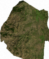
Satellite map
|

|
Satellite map
|
Notes and references
General remarks:
- The WIKIMEDIA COMMONS Atlas of the World is an organized and commented collection of geographical, political and historical maps available at Wikimedia Commons. The main page is therefore the portal to maps and cartography on Wikimedia. That page contains links to entries by country, continent and by topic as well as general notes and references.
- Every entry has an introduction section in English. If other languages are native and/or official in an entity, introductions in other languages are added in separate sections. The text of the introduction(s) is based on the content of the Wikipedia encyclopedia. For sources of the introduction see therefore the Wikipedia entries linked to. The same goes for the texts in the history sections.
- Historical maps are included in the continent, country and dependency entries.
- The status of various entities is disputed. See the content for the entities concerned.
- The maps of former countries that are more or less continued by a present-day country or had a territory included in only one or two countries are included in the atlas of the present-day country. For example the Ottoman Empire can be found in the Atlas of Turkey.
|
Entries available in the atlas
- General pages
- World
- Continents and oceans
- Themes
- Historical eras
- States with wide recognition
- States with limited recognition
- Dependencies and other overseas territories
- Country subdivisions
- Belgium
- China (mainland)
- India
- Pakistan
- Spain
- United Kingdom
- United States
- Russia
- Other
- Disputed subnational territories
- Other regions
- Cities
- Former sovereign states
- Former dependencies and overseas territories
- Former disputed territories
|


