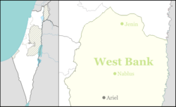
Mehola
Mehola | |
|---|---|
 | |
| Coordinates: 32°21′57″N 35°30′52″E / 32.36583°N 35.51444°E | |
| District | Judea and Samaria Area |
| Council | Bik'at HaYarden |
| Region | West Bank |
| Affiliation | Hapoel HaMizrachi |
| Founded | 1967 |
| Founded by | Bnei Akiva members |
| Population (2022)[1] | 688 |
| Website | www |
Mehola (Hebrew: מְחוֹלָה) is a religious moshav and Israeli settlement in the West Bank. Located in the Jordan Valley near the Green Line and the Palestinian village of Bardala,[2] it falls under the jurisdiction of Bik'at HaYarden Regional Council.[3] With an area of 5,000 dunams, in 2022 it had a population of 688.
The international community considers Israeli settlements in the West Bank illegal under international law, but the Israeli government disputes this.[4]
History
[edit]The village was established in 1967 by Bnei Akiva members. It was named after the biblical city of Abel-meholah (Judges 7:22, 1 Kings 4:12, 1 Kings 19:16), which was located in the area.[5]
The inhabitants of Mehola cultivate some of the village lands of the depopulated Palestinian village of Al-Fatur.[6]
In 1993, it was the site of Mehola Junction bombing.
In June 2012, the outpost Givat Sal'it (Hebrew: גבעת סלעית) in the northern Jordan Valley was retroactively legalised by redesignating it as a neighbourhood of Mehola, from which it is separated by a major inter-city highway.[7]
See also
[edit]References
[edit]- ^ "Regional Statistics". Israel Central Bureau of Statistics. Retrieved 21 March 2024.
- ^ Isabel Kershner,Strategic Corridor in West Bank Remains a Stumbling Block in Mideast Talks,', New York Times, 4 January 2014.
- ^ מחולה Archived 30 November 2021 at the Wayback Machine Bikat HaYarden Regional Council (in Hebrew)
- ^ "The Geneva Convention". BBC News. 10 December 2009. Retrieved 27 November 2010.
- ^ Carta's Official Guide to Israel and Complete Gazetteer to all Sites in the Holy Land. (3rd edition 1993) Jerusalem, Carta, p.322 , ISBN 965-220-186-3 (English)
- ^ Khalidi, W. (1992). All That Remains: The Palestinian Villages Occupied and Depopulated by Israel in 1948. Washington D.C.: Institute for Palestine Studies. p. 48. ISBN 0-88728-224-5.
- ^ "Watchdog says Israel 'legalises' another settler outpost". AFP. 17 July 2012. Retrieved 22 April 2013.[dead link]
External links
[edit]- Official website
 (in Hebrew)

