Nenda kwa yaliyomo

Faili:India location map.svg

Yaliyomo ya ukurasa hayatumiki katika lugha nyingine.
Kutoka Wikipedia, kamusi elezo huru

Faili halisi (faili la SVG, husemwa kuwa piseli 1,500 × 1,615, saizi ya faili: 1.23 MB)

Faili hili linatoka Wikimedia Commons. Maelezo yapo kule kwenye ukurasa wake wa maelezo unaonekana hapo chini.
Commons ni mahali mtandaoni pa kuhifadhia jalada na hati za picha na sauti zenye leseni huria. Unaweza kuisadia.

Muhtasari

Maelezo
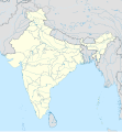
English: Location map of India.

Equirectangular projection. Strechted by 106.0%. Geographic limits of the map:

  • N: 37.5° N
  • S: 5.0° N
  • W: 67.0° E
  • E: 99.0° E
Made with Natural Earth. Free vector and raster map data @ naturalearthdata.com.
Tarehe
Chanzo Kazi yangu
Mwandishi Uwe Dedering at Kijerumani Wikipedia
Matoleo mengine

Derivative works of this file:

[hariri]

Hatimiliki

Uwe Dedering at Kijerumani Wikipedia, the copyright holder of this work, hereby publishes it under the following licenses:
GNU head Ruhusa inakubalika kunakili, kusambaza na/au kurekebisha chini ya matakwa ya GNU Free Documentation License, Toleo 1.2 au toleo lolote lile la baadaye ambalo litachapishwa na Free Software Foundation; lisilo na Sehemu Tofauti, lisilo na Maandishi-Kava-Kwa-Mbele, na lisilo na Maandishi-Kava-Kwa -Nyuma. Nakala ya hatimiliki inajumlishwa kwenye sehemu ilioitwa GNU Free Documentation License.
w:en:Creative Commons
sifa shiriki sawa
Uko huru:
  • kushiriki – kunakili na kusambaza kazi hiyo
  • kwa remix – kurekebisha kazi
Chini ya masharti yafuatayo:
  • sifa – Ni lazima utoe mkopo unaofaa, utoe kiungo cha leseni, na uonyeshe ikiwa mabadiliko yalifanywa. Unaweza kufanya hivyo kwa njia yoyote inayofaa, lakini si kwa njia yoyote inayopendekeza mtoa leseni akuidhinishe wewe au matumizi yako.
shiriki sawa – Ukichanganya, kubadilisha, au kujenga juu ya nyenzo, lazima usambaze michango yako chini ya same or compatible license kama ya awali.
w:en:Creative Commons
sifa shiriki sawa
This file is licensed under the Creative Commons Attribution-Share Alike 3.0 Germany license.
Uko huru:
  • kushiriki – kunakili na kusambaza kazi hiyo
  • kwa remix – kurekebisha kazi
Chini ya masharti yafuatayo:
  • sifa – Ni lazima utoe mkopo unaofaa, utoe kiungo cha leseni, na uonyeshe ikiwa mabadiliko yalifanywa. Unaweza kufanya hivyo kwa njia yoyote inayofaa, lakini si kwa njia yoyote inayopendekeza mtoa leseni akuidhinishe wewe au matumizi yako.
shiriki sawa – Ukichanganya, kubadilisha, au kujenga juu ya nyenzo, lazima usambaze michango yako chini ya same or compatible license kama ya awali.
Unaweza kuchagua leseni ya chaguo lako.

Depiction of India's borders

  • The territorial boundaries of India are shown as per the actual ground situation in accordance with international practices followed by the United Nations and the National Geographic Society
  • This map is meant to be for illustrative purpose only and is not authenticated by official government sources. Please check the list of sources and references used to create the map for a measure of accuracy and verifiability.
  • The usage of these maps in India, Pakistan and China are governed by different laws that restrict depictions of boundaries other than what is officially recognized by the state. Please check local laws and modify the map accordingly before use.

Explanation of disputed boundaries

  • Boundary of Indian claim : The territory India claims is legally theirs, but the claim is disputed by China and Pakistan.
  • Line of Control/Line of Conflict : The de facto administrative boundary recognised by the international community. This UN ceasefire line is considered as a temporary solution to an ongoing conflict since the departure of the British Raj.

Borders of disputed regions

The extent of the former territory of the British Indian Empire, seceeded by Republic of India depicted on this map may not be accepted by most countries as legal due to ongoing border disputes:

  • The northern Himalayan region of the disputed territory Indian-administered Kashmir is claimed by India including (Pakistan-administered Kashmir) and the Chinese Occupied territory of (Ladakh plateau). It is currently divided between all three countries since 1972. See also Line of Control and Line of Actual Control.
  • Siachen glacier (shown white) is an actively contested region between India and Pakistan. At present the region is in control of India since 1984.
  • The northeastern territory of Arunachal Pradesh is almost entirely claimed by China as part of its Tibetan territory.
  • Minor areas of eastern Ladakh, Himachal Pradesh and Uttarakhand on the Chinese frontier are claimed by China. These areas are under Indian control.
  • A small area of Uttarakhand adjoining the Nepal border along the Sarda river is disputed between the two countries.

For a detailed map of all disputed regions in South Asia, see Image:India disputed areas map.svg

Internal borders

The borders of the state of Meghalaya, Assam and Arunachal Pradesh are shown as interpreted from the North-Eastern Areas (Reorganisation) Act, 1971, but has yet to be verified.

Territorial waters

The limit of the territorial waters of India extends to twelve nautical miles measured from the appropriate baseline. See this archive copy at the Wayback Machine for more information.

Kumbukumbu ya upakizaji wa asili

Transferred from de.wikipedia to Commons by Uwe Dedering.

The original description page was here. All following user names refer to de.wikipedia.
  • 2010-02-21 16:39 Uwe Dedering 1500×1615× (2412750 bytes) {{Information |Beschreibung = very little borders style changes |Quelle = |Urheber = |Datum = |Genehmigung = |Andere Versionen = |Anmerkungen = }}
  • 2010-02-21 14:16 Uwe Dedering 1500×1615× (2411518 bytes) {{Information |Beschreibung = North now 37.5, changed disputed areas |Quelle = |Urheber = |Datum = |Genehmigung = |Andere Versionen = |Anmerkungen = }}
  • 2010-02-20 16:44 Uwe Dedering 1500×1540× (2246850 bytes) {{Information |Beschreibung = Location map of India. Equirectangular projection. Strechted by 106.0%. Geographic limits of the map: * N: 36.0° N * S: 5.0° N * W: 67.0° E * E: 99.0° E Made with Natural Earth. Free vector and raster map data @ nat

Captions

Add a one-line explanation of what this file represents

Items portrayed in this file

depicts Kiingereza

copyright status Kiingereza

copyrighted Kiingereza

20 Februari 2010

Historia ya faili

Bonyeza tarehe/saa kuona faili kama ilivyoonekana wakati huo.

(mpya | zamani) Tazama (10 ya karibu zaidi | ) (10 | 20 | 50 | 100 | 250 | 500)
Tarehe/SaaPicha ndogoVipimoMtumiajiMaelezo
sasa hivi09:24, 4 Aprili 2021Picha ndogo ya toleo la 09:24, 4 Aprili 20211,500 × 1,615 (1.23 MB)TKsdik8900Fulfilling the edit request (File talk:India location map.svg#Upload more compact version of India location map) by C1MM
16:50, 14 Oktoba 2020Picha ndogo ya toleo la 16:50, 14 Oktoba 20201,500 × 1,615 (1.64 MB)NordNordWestcorrect Telangana/Andhra Pradesh
23:10, 3 Novemba 2019Picha ndogo ya toleo la 23:10, 3 Novemba 20191,500 × 1,615 (1.62 MB)RaviCslight colour change for consistency
23:06, 3 Novemba 2019Picha ndogo ya toleo la 23:06, 3 Novemba 20191,500 × 1,615 (1.62 MB)RaviC== {{int:filedesc}} == {{Information |Description={{en|Location map of India. Equirectangular projection. Strechted by 106.0%. Geographic limits of the map: * N: 37.5° N * S: 5.0° N * W: 67.0° E * E: 99.0° E Made with Natural Earth. Free vector and raster map data @ naturalearthdata.com.}} |Source={{own}} |Date=2010-02-20 |Author={{user at project|Uwe Dedering|wikipedia|de}} |Permission= |other_versions={{DerivativeVersions|India location map2.svg|India location map 3.png}} {{Other versions/I...
21:42, 19 Agosti 2014Picha ndogo ya toleo la 21:42, 19 Agosti 20141,500 × 1,615 (1.59 MB)M0ttyUpdate by Sémhur : add the state of Telangana
11:51, 7 Juni 2011Picha ndogo ya toleo la 11:51, 7 Juni 20111,500 × 1,615 (1.49 MB)NordNordWestNagaland corrected
16:10, 18 Januari 2011Picha ndogo ya toleo la 16:10, 18 Januari 20111,500 × 1,615 (2.36 MB)Uwe DederingReverted to version as of 15:50, 17 January 2011 and again, layer structure destroyed, and first discuss this!
19:04, 17 Januari 2011Picha ndogo ya toleo la 19:04, 17 Januari 20111,500 × 1,615 (1.52 MB)AshwiniKalantriThe disputed land of Kashmir are shown in a different shade.
15:50, 17 Januari 2011Picha ndogo ya toleo la 15:50, 17 Januari 20111,500 × 1,615 (2.36 MB)Uwe DederingReverted to version as of 11:34, 22 September 2010 vandalism
23:30, 16 Januari 2011Picha ndogo ya toleo la 23:30, 16 Januari 20111,500 × 1,615 (2.01 MB)AshwiniKalantri{{Information |Description=Location Map of India |Source= |Date= |Author= |Permission= |other_versions= }}
(mpya | zamani) Tazama (10 ya karibu zaidi | ) (10 | 20 | 50 | 100 | 250 | 500)

Matumizi ya faili ulimwenguni

Data juu