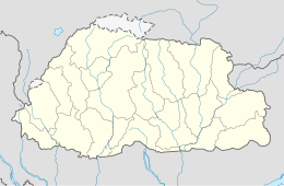
2009 Bhutan earthquake
| UTC time | 2009-09-21 08:53:05 |
|---|---|
| ISC event | 13788745 |
| USGS-ANSS | ComCat |
| Local date | 21 September 2009 |
| Local time | 14:53:05 |
| Magnitude | 6.1 Mw[1][2] |
| Depth | 14 kilometres (8.7 mi) |
| Epicenter | 27°20′46″N 91°24′43″E / 27.346°N 91.412°E |
| Areas affected | Bhutan India China |
| Max. intensity | MMI VI (Strong) |
| Casualties | 12 dead, 15 injured[3] |
The 2009 Bhutan earthquake occurred on 21 September at 14:53 BTT (08:53 UTC) in the eastern region of Bhutan with moment magnitude of 6.1. The epicenter was situated at 180 kilometres (110 mi) east of the capital Thimphu, in Monggar District.[4] However, Bangladesh and northern India also felt it, with residents in Guwahati, Assam reporting cracks in buildings.[5] The tremors were felt as far as Tibet.[6]
At least eleven people are reported to have been killed—seven in Bhutan, four in India.[2] The death toll, initially ten, increased when one more died in the night.[7][8][9][10] At least fifteen were wounded.[2] Many of the deaths in Bhutan came about when their houses fell in on top of them.[2] The Indians were construction workers whose road fell through.[2] At least 5,167 homes and buildings were damaged or destroyed.[3]
One businessman said the earthquake happened as shopping was underway for the Blessed Rainy Day ceremony of Buddhism.[5] Another inhabitant said it "made the surrounding hills look like they were throwing up dust" and that "the road was suddenly filled with boulders and mud".[2] Thousands are living outdoors as a result.[5] Children were crushed under structures as they caved in.[5] Roads were blocked but these were cleaned up relatively quickly.[5] Monasteries were also struck.[10] People ran for their lives out of their homes.[10]
Aftershocks
[edit]There were at least seven aftershocks.[2]
An earthquake measuring 5.7 on the Richter scale was heard in Myanmar and the northeast Indian states of Assam, Arunachal Pradesh, Nagaland and Manipur and the following day.[1]
Reaction
[edit]Prime Minister of Bhutan Jigme Thinley said the earthquake was "one of the biggest disasters in recent times".[5] He also said the length of the earthquake (95 seconds) was "very long".[5] He and his home minister embarked on a visit to the region.[5]
References
[edit]- ^ a b "Another tremor jolts northeast, Monday's quake toll 11". The Times of India. 2009-09-22. Retrieved 2009-09-23.
- ^ a b c d e f g Wasbir Hussain (2009-09-22). "Strong earthquake kills 12 in Bhutan". The Sydney Morning Herald. Archived from the original on 13 October 2009. Retrieved 2009-09-23.
- ^ a b "Trashigang is prepared for disasters". Kuensel Online. 7 October 2017. Retrieved 12 September 2024.
- ^ USGS profile Archived 2009-10-07 at the Wayback Machine. United States Geological Survey.
- ^ a b c d e f g h "Bhutan PM laments quake disaster". BBC News. 2009-09-23. Archived from the original on 29 September 2009. Retrieved 2009-09-23.
- ^ Seven dead as quake rocks Bhutan, India and Tibet Archived 2012-09-05 at the Wayback Machine. Earth Times. September 21, 2009.
- ^ Earthquake kills at least 7 in Bhutan, shakes Assam. The Indian Express. September 21, 2009.
- ^ Earthquake hits Bhutan Archived 2009-09-26 at the Wayback Machine. Bhutan Broadcasting Service. September 21, 2009.
- ^ Bhutan hit by strong earthquake September 21, 2009. BBC.
- ^ a b c "Bhutan quake: Death toll rises". Independent Online. 2009-09-22. Retrieved 2009-09-23.
Further reading
[edit]- Kayal, J. R.; Arefiev, Sergei S.; Baruah, Saurabh; Tatevossian, Ruben; Gogoi, Naba; Sanoujam, Manichandra; Gautam, J. L.; Hazarika, Devajit; Borah, Dipak (2010), "The 2009 Bhutan and Assam felt earthquakes (Mw6.3 and 5.1) at the Kopili fault in the northeast Himalaya region", Geomatics, Natural Hazards and Risk, 1 (3): 273–281, doi:10.1080/19475705.2010.486561
External links
[edit] Ten dead after earthquake in Bhutan at Wikinews
- The International Seismological Centre has a bibliography and/or authoritative data for this event.


