Chuqi Luk'anani: Difference between revisions
Appearance
Content deleted Content added
JJMC89 bot (talk | contribs) Migrate {{Infobox mountain}} coordinates parameters to {{Coord}}, see Wikipedia:Coordinates in infoboxes |
→top: add short description |
||
| Line 1: | Line 1: | ||
{{short description|Mountain in Peru}} |
|||
{{Infobox mountain |
{{Infobox mountain |
||
| name = Chuqi Luk'anani |
| name = Chuqi Luk'anani |
||
Latest revision as of 05:24, 15 April 2022
| Chuqi Luk'anani | |
|---|---|
| Highest point | |
| Elevation | 5,200 m (17,100 ft)[1] |
| Coordinates | 16°59′14″S 70°5′13″W / 16.98722°S 70.08694°W |
| Geography | |
| Location | Peru, Puno Region, El Collao Province |
| Parent range | Andes |
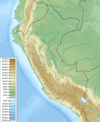
Chuqi Luk'anani (Aymara chuqi gold, luk'ana finger,[2] -ni a suffix to indicate ownership, "the one with a gold finger", also spelled Choquelocanani, Chuquilacani) is a mountain in the Andes of southern Peru, about 5,200 metres (17,060 ft) high. It is situated in the Puno Region, El Collao Province, Santa Rosa District. Chuqi Luk'anani lies southeast of the mountain Panti Usu.[1][3]
References
[edit]- ^ a b escale.minedu.gob.pe - UGEL map of the Candarave Province (Tacna Region)
- ^ Radio San Gabriel, "Instituto Radiofonico de Promoción Aymara" (IRPA) 1993, Republicado por Instituto de las Lenguas y Literaturas Andinas-Amazónicas (ILLLA-A) 2011, Transcripción del Vocabulario de la Lengua Aymara, P. Ludovico Bertonio 1612 (Spanish-Aymara-Aymara-Spanish dictionary)
- ^ Peru 1:100,000, Hospicio 2837, Map prepared and published by the Defense Mapping Agency, Hydrographic/Topographic Center, Bethesda, MD

