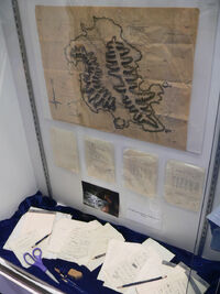
Rousseau's full map and notations, seen at the Comic-Con 2009 auction preview.
Danielle Rousseau kept several maps and notes that she had made or acquired during her 16 years on the Island, containing diagrams, maps, equations, and various notations. Sayid, after escaping imprisonment at Rousseau's camp, took the maps and notes with him back to the survivor's camp. ("Solitary") He recruited Shannon to help translate the French notations that accompanied the mathematical equations on the maps and notes. Some of the notations that originally appeared to Shannon to be gibberish were later tranlsated as lyrics to the song "La Mer", from an animated children's movie. ("Whatever the Case May Be") Sayid retained possession of the pages, excepting a brief period during which Hurley took some of them, until he left the Island. ("There's No Place Like Home, Part 2") ("Numbers") Not long after the crash of Ajira Airways Flight 316 on the Hydra island, one of its survivors, Caesar, found what appeared to be a folded up version of Rousseau's map. ("The Life and Death of Jeremy Bentham")
Rousseau's crater map[]
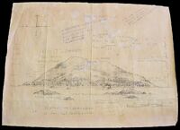
Rousseau's crater map

Rousseau's crater map, translated.
One of Rousseau's maps is a profile of the island crater, modeled after a tuff cone. It includes song lyrics and equations, in addition to altitudes, a compass rose, and other geographical notes. The crater is indicated to reach an altitude of approximately 2750 meters (9000 ft), although comparable tuff cones are much shorter. For example, Koko Head, on Oahu, reaches a maximum altitude of 368m (1208ft). The scale indicates that the crater is 200 km (120 mi) across, although this distance is not corroborated by other maps indications of distance. It is one of the maps used by Sayid to form the "triangle".
Rousseau's summit map[]
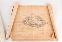
Rousseau's summit map hero prop
Another of Rousseau's maps is a profile of an island summit.
Rousseau's full island map[]
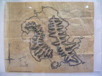
Full high quality map as seen at Comic-Con 2009 (English version)
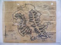
French version, transcribed (subjective in parts) [1]
One of Rousseau's maps shows the entirety of the island. Sayid uses this map to indicate the location of the Dark Territory. ("Numbers") Sayid also uses this map during his navigation to the Others' decoy village, with Sun, and Jin while on the Elizabeth. During this time, Sayid made some notations on the west coast, presumably trying to orient himself and make sense of Rousseau's cartography. ("The Glass Ballerina")
The scale of the map indicates that the island is approximately 45 km (30 mi) wide at its widest point (east to west), and approximately 60 km (40 mi) long at its longest point (north to south). The adjacent images show the notations on Rousseau's map and their translations. (Note: The adjacent images are missing the northmost and southmost portions of the map)
Other notes[]
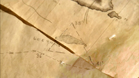
A triangle formed by overlaying Rousseau's maps
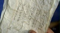
Some of Rousseau's notes were simply diagrams, writings, equations, or lists of numbers. In need of a distress beacon to go aboard the second raft, Hurley and Jack asked Sayid for the maps in order to obtain batteries from Rousseau. Upon seeing the papers, Hurley immediately recognized the Numbers from his winning lottery ticket, and subsequently went out to find Rousseau in search of their meaning. Rousseau confirmed Hurley's belief that the Numbers are cursed, acknowledging that they brought her to the Island, causing her to lose everything she cares about. ("Numbers")
In an effort to make sense of the maps, Sayid later realized that he could arrange the maps to reveal a triangle, pinpointing a location on the Island. He theorized that it could be the transmitter sending out the distress signal and its power source, and later thought it could be the "black rock" from the dream Claire wrote about in her diary. ("Special")
Trivia[]
- When Sayid initially takes the maps from Rousseau's shelter, the visible open map on the table is a reversed image (a horizontal flip) of the full map.
- Danielle's map is included as a prop in the Shannon action figure set.
- The map shows two smaller Islands, with the names given by Rousseau as "Robert Isl" and "Alex Isl". It was confirmed that one of these islands is Hydra Island. (Official Lost Podcast/March 26, 2007)
- The word "exposé" can be seen in the center of the crater maps
- The note on which Hurley recognized The Numbers contained the 6 numbers (4, 8, 15, 16, 23, 42) repeated in seven rows. The result is that there are 42 whole numbers on the page.
- The highest peak is reported to be 2257 meters on Danielle's map; if we sum the numbers, obtain 16.
See also[]
- The Numbers
- "La Mer"
- Other maps
- The Island
| |||||||||||||||||||||||

