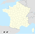
Fichier:France location map-Departements 1791.svg
Apparence

Taille de cet aperçu PNG pour ce fichier SVG : 624 × 600 pixels. Autres résolutions : 250 × 240 pixels | 499 × 480 pixels | 799 × 768 pixels | 1 066 × 1 024 pixels | 2 131 × 2 048 pixels | 2 000 × 1 922 pixels.
Fichier d’origine (Fichier SVG, nominalement de 2 000 × 1 922 pixels, taille : 568 kio)
Historique du fichier
Cliquer sur une date et heure pour voir le fichier tel qu'il était à ce moment-là.
| Date et heure | Vignette | Dimensions | Utilisateur | Commentaire | |
|---|---|---|---|---|---|
| actuel | 8 mai 2015 à 23:17 |  | 2 000 × 1 922 (568 kio) | Flappiefh | Fixed Barcillonnette canton. |
| 8 mai 2015 à 17:08 |  | 2 000 × 1 922 (595 kio) | Flappiefh | Fixed Glère area. | |
| 7 septembre 2014 à 19:46 |  | 2 000 × 1 922 (564 kio) | Sémhur | Frontières de la Suisse | |
| 7 septembre 2014 à 19:45 |  | 2 000 × 1 922 (565 kio) | Sémhur | update | |
| 29 mai 2014 à 18:49 |  | 2 000 × 1 922 (507 kio) | Sémhur | == {{int:filedesc}} == {{Information |Description={{Multilingual description |en= Map of Departments of France in 1791. |fr= Carte des Départements français en 1791. }} |Source= * [[:File:F... |
Utilisation du fichier
Les 3 pages suivantes utilisent ce fichier :
Usage global du fichier
Les autres wikis suivants utilisent ce fichier :
- Utilisation sur en.wikipedia.org


