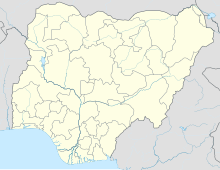
Old Kaduna Airport
Appearance
Old Kaduna Airport | |||||||||||
|---|---|---|---|---|---|---|---|---|---|---|---|
| Summary | |||||||||||
| Airport type | Military | ||||||||||
| Location | Kaduna, Nigeria | ||||||||||
| Elevation AMSL | 2,126 ft / 648 m | ||||||||||
| Coordinates | 10°35′55″N 7°26′55″E / 10.59861°N 7.44861°E | ||||||||||
| Map | |||||||||||
 | |||||||||||
| Runways | |||||||||||
| |||||||||||
Old Kaduna Airport is an airport serving Kaduna, the capital of the Kaduna State of Nigeria. Its public uses and airport codes have been transferred to Kaduna International Airport, located 17 kilometres (11 mi) to the northwest.
The Kaduna non-directional beacon (Ident: KD) and VOR-DME (Ident: KUA) are located on the field.[3]
It appears to be the headquarters of the Nigerian Air Force Training Command with a flying training group and a ground training group at the base. The command is chiefly responsible for implementing NAF training policies. Ground training is also provided for support services and technical personnel.[4]
- 301 Flying Training School, Kaduna
- 303 Flying Training School, Kano
- 320 Technical Training Group, Kaduna
- 325 Ground Training Group, Kaduna
See also
[edit]References
[edit]- ^ Old Kaduna Airport[usurped] at World Aero Data
- ^ Old Kaduna Airport
- ^ "SkyVector: Flight Planning / Aeronautical Charts". skyvector.com. Retrieved 2018-08-21.
- ^ "The Nigerian Air Force Operational Commands, Training Command (TC)". Archived from the original on 2013-06-04. Retrieved 2013-10-25.

