Aguas Dulces: Difference between revisions
Appearance
Content deleted Content added
started page |
No edit summary Tags: Mobile edit Mobile web edit |
||
| (21 intermediate revisions by 10 users not shown) | |||
| Line 3: | Line 3: | ||
|other_name = |
|other_name = |
||
|settlement_type = Resort |
|settlement_type = Resort |
||
|image_skyline = |
|image_skyline = |
||
|imagesize = |
|imagesize = |
||
|image_caption = |
|image_caption = |
||
| Line 9: | Line 9: | ||
|pushpin_label_position = right |
|pushpin_label_position = right |
||
|pushpin_map_caption = Location in Uruguay |
|pushpin_map_caption = Location in Uruguay |
||
|coordinates_display = inline,title |
|||
|coordinates_region = UY-RO |
|||
|subdivision_type = Country |
|subdivision_type = Country |
||
|subdivision_name = {{flag|Uruguay}} |
|subdivision_name = {{flag|Uruguay}} |
||
| Line 20: | Line 18: | ||
|established_date = |
|established_date = |
||
|area_total_km2 = |
|area_total_km2 = |
||
|population_as_of = |
|population_as_of = |
||
|population_total = |
|population_total = |
||
|population_density_km2 = |
|population_density_km2 = |
||
|blank1_name = [[Köppen climate classification|Climate]] |
|||
|blank1_info = [[Humid subtropical climate|Cfa]] |
|||
|timezone = [[UTC]] -3 |
|timezone = [[UTC]] -3 |
||
|coordinates = {{coord|34|16|35|S|53|47|0|W|region:UY-RO|display=inline,title}} |
|||
|latd=34|latm=16|lats=35|latNS=S |
|||
|longd=53|longm=47|longs=0|longEW=W |
|||
|elevation_m = |
|elevation_m = |
||
|postal_code_type = Postal code |
|postal_code_type = Postal code |
||
|postal_code = 27202 |
|postal_code = 27202 |
||
| |
| |
||
|area_code = +598 4475 (+4 digits) |
|||
|website = |
|website = |
||
}} |
}} |
||
'''Aguas Dulces''' is a resort in the [[Rocha Department]] of southeastern [[Uruguay]]. |
'''Aguas Dulces''' is a resort in the [[Rocha Department]] of southeastern [[Uruguay]]. |
||
==Geography== |
|||
The resort is located at the east end (on [[Kilometre Zero#Uruguay|Km. 277.5]]) of [[Route 10 (Uruguay)|Route 10]] and the south end of Route 16, on the coast of the [[Atlantic Ocean]], about {{convert|11|km}} southeast of [[Castillos]] and between the lagoons Laguna de Castillos and Laguna Negra. Its nominal distance from [[Montevideo]] is 288 km, using [[Ruta Interbalnearia]], [[Route 9 (Uruguay)|Route 9]] and Route 16 (via Castillos). |
|||
==Population== |
==Population== |
||
In |
In Aguas Dulces had a population of .<ref>{{cite web|url=http://www.ine.gub.uy///. |title= Rocha |publisher=INE |date= |= |= }}</ref> |
||
{| class="wikitable" |
{| class="wikitable" |
||
! Year || Population |
! Year || Population |
||
|- align="right" |
|- align="right" |
||
| 1963 || 74 |
| 1963 || 74 |
||
|- align="right" |
|- align="right" |
||
| 1975 || 120 |
| 1975 || 120 |
||
|- align="right" |
|- align="right" |
||
| 1985 || 145 |
| 1985 || 145 |
||
|- align="right" |
|- align="right" |
||
| 1996 || 247 |
| 1996 || 247 |
||
|- align="right" |
|- align="right" |
||
| 2004 || |
| 2004 || 409 |
||
|- align="right" |
|||
| 2011 || 417 || 1,596 |
|||
|} |
|} |
||
Source: ''Instituto Nacional de Estadística de Uruguay''<ref>{{cite web |
Source: ''Instituto Nacional de Estadística de Uruguay''<ref>{{cite web|url=http://www.ine.gub.uy/biblioteca/toponimico/TOPOletraA.doc |title=1963–1996 Statistics / A |publisher=Instituto Nacional de Estadística de Uruguay |date=2004 |format=DOC |accessdate=25 July 2011}}</ref> |
||
==References== |
==References== |
||
| Line 55: | Line 60: | ||
==External links== |
==External links== |
||
*[http://www.ine.gub.uy/mapas/ |
*[http://www.ine.gub.uy/mapas//%%%.pdf INE map of Aguas Dulces] |
||
*[http://www.turismorocha.gub.uy/index.php?option=com_k2&view=item&layout=item&id=30&Itemid=185 Tourist information for Aguas Dulces] |
|||
{{Coast of Rocha}} |
{{Coast of Rocha}} |
||
{{Rocha Department}} |
{{Rocha Department}} |
||
{{Authority control}} |
|||
| ⚫ | |||
[[Category:Populated places in the Rocha Department]] |
[[Category:Populated places in the Rocha Department]] |
||
[[Category: |
[[Category: Uruguay]] |
||
| ⚫ | |||
Latest revision as of 10:30, 8 February 2023
Aguas Dulces | |
|---|---|
Resort | |
 | |
| Coordinates: 34°16′35″S 53°47′0″W / 34.27639°S 53.78333°W | |
| Country | |
| Department | Rocha Department |
| Population (2011) | |
• Total | 417 |
| Time zone | UTC -3 |
| Postal code | 27202 |
| Dial plan | +598 4475 (+4 digits) |
| Climate | Cfa |
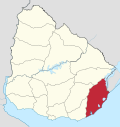
Aguas Dulces is a resort in the Rocha Department of southeastern Uruguay.
Geography
[edit]The resort is located at the east end (on Km. 277.5) of Route 10 and the south end of Route 16, on the coast of the Atlantic Ocean, about 11 kilometres (6.8 mi) southeast of Castillos and between the lagoons Laguna de Castillos and Laguna Negra. Its nominal distance from Montevideo is 288 km, using Ruta Interbalnearia, Route 9 and Route 16 (via Castillos).
Population
[edit]In 2011 Aguas Dulces had a population of 417 permanent inhabitants and 1,596 dwellings.[1]
| Year | Population | Dwellings |
|---|---|---|
| 1963 | 74 | 562 |
| 1975 | 120 | 1,027 |
| 1985 | 145 | 989 |
| 1996 | 247 | 1,183 |
| 2004 | 409 | 1,437 |
| 2011 | 417 | 1,596 |
Source: Instituto Nacional de Estadística de Uruguay[2]
References
[edit]- ^ "Censos 2011 Rocha (needs flash plugin)". INE. 2012. Archived from the original on 11 November 2012. Retrieved 30 August 2012.
- ^ "1963–1996 Statistics / A". Instituto Nacional de Estadística de Uruguay. 2004. Archived from the original (DOC) on 21 July 2011. Retrieved 25 July 2011.
External links
[edit]


