Category:Saint Anne Gate
| Object location | | View all coordinates using: OpenStreetMap |
|---|
Media in category "Saint Anne Gate"
The following 18 files are in this category, out of 18 total.
-
 Cottonera WV banner.jpg 11,590 × 1,658; 2.58 MB
-
 Fortini ta Felic, Cospicua, Malta - panoramio (3).jpg 2,624 × 1,968; 1.69 MB
-
 Malta - Senglea - Pjazzetta Gorg Mitrowich+Main Gate+Saint Anne Gate 01 ies.jpg 5,616 × 3,744; 11.9 MB
-
 Malta - Senglea - Saint Anne Gate 01 ies.jpg 5,616 × 3,744; 14.39 MB
-
 Malta - Senglea - Saint Anne Gate 02 ies.jpg 3,744 × 5,616; 13.05 MB
-
 Malta - Senglea - Saint Anne Gate 03 ies.jpg 5,616 × 3,744; 13.51 MB
-
 Malta - Senglea - Saint Anne Gate 04 ies.jpg 5,616 × 3,744; 16.37 MB
-
 Malta - Senglea - Triq il-31 ta' Marzu + Saint Anne Gate + Fort Saint Michael 01 ies.jpg 5,616 × 3,744; 17.99 MB
-
 Malta - Senglea - Triq il-31 ta' Marzu + Saint Anne Gate + Fort Saint Michael 02 ies.jpg 5,616 × 3,744; 17.7 MB
-

-
 Malta Valletta Panorama 11.jpg 11,590 × 1,813; 2.86 MB
-
 Malta-city-wall.jpg 1,728 × 1,152; 1.66 MB
-
 Nördliche Stadtbefestigung von Senglea.jpg 5,184 × 3,456; 7.44 MB
-
 Senglea - Malta.jpg 2,418 × 1,600; 1.77 MB
-
 Senglea Gate.jpg 2,439 × 1,700; 1.68 MB
-
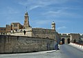
 St Anne Gate.jpg 1,080 × 1,620; 456 KB
-
 St Michael Bastion - Senglea 1.jpg 4,608 × 3,072; 898 KB
-
 Sudika Isla gate.jpg 1,200 × 798; 136 KB
.jpg)


