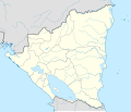
Datei:Nicaragua bluemarble location map.jpg
Erscheinungsbild

Gress dea Voaschau: 704 × 599 Pixel Weitere Auflésungan: 282 × 240 Pixel | 564 × 480 Pixel | 902 × 768 Pixel | 1.203 × 1.024 Pixel | 1.400 × 1.192 Pixel.
Version in hechara Auflesung (1.400 × 1.192 Pixel, Dateigress: 725 KB, MIME-Typ: image/jpeg)
Dateiversiona
Wensd auf an Zeitpunkt klickst, nacha konst a friaane Version lodn.
| Version vom | Vorschaubuidl | Dimensióna | Nutzer | Kommentar | |
|---|---|---|---|---|---|
| aktuell | 22:06, 17. Few. 2010 |  | 1.400 × 1.192 (725 KB) | Alexrk2 | +relief |
| 21:49, 16. Few. 2010 |  | 1.400 × 1.192 (698 KB) | Alexrk2 | == Summary == {{Information |Description= {{de|Bluemarble Positionskarte Nicaragua mit Departamentos, Quadratische Plattkarte, N-S-Streckung 100 %. Geographische Begrenzung der Karte:}} {{en|Bluemarble Location map [[:en:Nicaragua|Nicara |
Dateivawendung
Seitn wo de Datei nutzn:
Globale Dateinutzung
D'noochéfóiganden åndern Wikis vawénden dé Datei:
- Vawendung af be.wikipedia.org
- Vawendung af de.wikipedia.org
- Vawendung af frr.wikipedia.org
- Vawendung af mn.wikipedia.org
- Vawendung af pl.wikipedia.org
- Vawendung af uk.wikipedia.org


