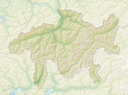
Surava
Appearance
Surava | |
|---|---|
 | |
| Coordinates: 46°39′N 9°36′E / 46.650°N 9.600°E | |
| Country | Switzerland |
| Canton | Graubünden |
| District | Albula |
| Area | |
| • Total | 6.68 km2 (2.58 sq mi) |
| Elevation | 904 m (2,966 ft) |
| Population (2006) | |
| • Total | 199 |
| • Density | 30/km2 (77/sq mi) |
| Time zone | UTC+01:00 (Central European Time) |
| • Summer (DST) | UTC+02:00 (Central European Summer Time) |
| Postal code(s) | 7472 |
| SFOS number | 3515 |
| Surrounded by | Alvaneu, Brienz/Brinzauls, Tiefencastel |
| Website | www SFSO statistics |
Surava was a municipality of the district Albula in the canton of Graubünden in Switzerland. On 1 January 2015, the former municipalities of Alvaschein, Mon, Stierva, Tiefencastel, Alvaneu, Brienz/Brinzauls and Surava merged to form the new municipality of Albula/Alvra.


