Alto Malcantone
Appearance
Alto Malcantone | |
|---|---|
 Arosio | |
| Coordinates: 46°2′N 8°53′E / 46.033°N 8.883°E | |
| Country | Switzerland |
| Canton | Ticino |
| District | Lugano |
| Area | |
| • Total | 22.1 km2 (8.5 sq mi) |
| Elevation | 810 m (2,660 ft) |
| Population (31 December 2018)[2] | |
| • Total | 1,400 |
| • Density | 63/km2 (160/sq mi) |
| Time zone | UTC+01:00 (Central European Time) |
| • Summer (DST) | UTC+02:00 (Central European Summer Time) |
| Postal code(s) | 6937-6939 |
| SFOS number | 5237 |
| Surrounded by | Aranno, Bedano, Bioggio, Cademario, Curiglia con Monteviasco (IT-VA), Gravesano, Indemini, Manno, Miglieglia, Sigirino, Torricella-Taverne |
| Website | www SFSO statistics |
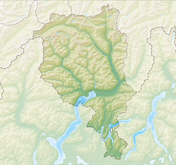
Alto Malcantone is a municipality of the district of Lugano in the canton of Ticino in Switzerland. It was formed on 13 March 2005 from the earlier municipalities of Arosio, Breno, Fescoggia, Mugena and Vezio.
References
- ↑ 1.0 1.1 "Arealstatistik Standard - Gemeinden nach 4 Hauptbereichen". Federal Statistical Office. Retrieved 13 January 2019.
- ↑ "Ständige Wohnbevölkerung nach Staatsangehörigkeitskategorie Geschlecht und Gemeinde; Provisorische Jahresergebnisse; 2018". Federal Statistical Office. 9 April 2019. Retrieved 11 April 2019.
Other websites
![]() Media related to Alto Malcantone at Wikimedia Commons
Media related to Alto Malcantone at Wikimedia Commons
- Official website of Alto Malcantone (in Italian)


