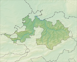
Liestal
Appearance
Liestal | |
|---|---|
 | |
| Coordinates: 47°28′N 7°44′E / 47.467°N 7.733°E | |
| Country | Switzerland |
| Canton | Basel-Landschaft |
| District | Liestal |
| Government | |
| • Mayor | Stadtpräsident Lukas Ott GPS/PES (as of 2014) |
| Area | |
| • Total | 18.19 km2 (7.02 sq mi) |
| Elevation | 326 m (1,070 ft) |
| Population (31 December 2018)[2] | |
| • Total | 14,390 |
| • Density | 790/km2 (2,000/sq mi) |
| Time zone | UTC+01:00 (Central European Time) |
| • Summer (DST) | UTC+02:00 (Central European Summer Time) |
| Postal code(s) | 4410 |
| SFOS number | 2829 |
| Surrounded by | Arisdorf, Bubendorf, Frenkendorf, Füllinsdorf, Hersberg, Lausen, Nuglar-St. Pantaleon (SO), Seltisberg |
| Twin towns | Onex (Switzerland), Sacramento (USA), Waldkirch (Germany) |
| Website | www SFSO statistics |
Liestal is a town in Switzerland. It is the capital of the Swiss canton of Basel-Landschaft. It is 17 kilometres (11 miles) south of Basel. As of December 2012, 13,771 people lived there.[3]
References
[change | change source]- ↑ 1.0 1.1 "Arealstatistik Standard - Gemeinden nach 4 Hauptbereichen". Federal Statistical Office. Retrieved 13 January 2019.
- ↑ Error: Unable to display the reference properly. See the documentation for details.
- ↑ "Cantonal Population Statistics". Statistical Office of Basel-Landschaft. 2 September 2014. Archived from the original on 6 July 2011. Retrieved 4 September 2014.
Other websites
[change | change source]![]() Media related to Liestal at Wikimedia Commons
Media related to Liestal at Wikimedia Commons
- Official website of Liestal (in German)
- Liestal in German, French and Italian in the online Historical Dictionary of Switzerland.


