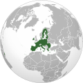
මුල් ගොනුව (SVG ගොනුව, නාමමාත්රිකව 792 × 792 පික්සල්, ගොනු විශාලත්වය: 5.4 මෙ.බ.)
මෙම ගොනුව Wikimedia Commons වෙතින් වන අතර අනෙකුත් ව්යාපෘතීන් විසින්ද භාවිතා කල හැක.
එහි ගොනු විස්තර පිටුව තුල අඩංගු විස්තර මෙහි පහත දැක්වෙයි.
මෙම කෘතියෙහි හිමිකම් අයිතීන් දරන්නා වන මම,පහත වරපත යටතේ එය ප්රකාශයට පත් කරමි:
ඔබ නිදහස්:
බෙදාහදා ගැනීමට – කාර්යය පිටපත් කිරීමට,බෙදා හැරීමට සහ සම්ප්රේෂණය කිරීමටනැවත සංකලනය කිරීමට – කාර්යයට අනුවර්තනය වීමට
පහත කොන්දේසිවලට යටත්ව:
attribution – වරපත වෙත බැඳියක්ද සපයමින් ඔබ විසින් සුදුසු කර්තෘභාරය ප්රදානය කල යුතු අතර, කිසියම් වෙනස්වීම් සිදුකලේ නම් එයද සඳහන් කල යුතු වෙයි. ඕනෑම සුදුසු ආකාරයට මෙය ඔබ විසින් සිදුකල හැකි මුත්, වරපත්දායකයා විසින් ඔබ හෝ ඔබගේ භාවිතය හෝ පිටසන් කරන බවට ඇඟවෙන ලෙසින් එය සිදු නොකල යුතු වෙයි. https://creativecommons.org/licenses/by/3.0 CC BY 3.0 Creative Commons Attribution 3.0 true true
This image is a derivative work of the following images:
File:Global_European_Union.svg licensed with Cc-by-3.0
2009-06-21T16:53:41Z Ssolbergj 541x541 (499935 Bytes) Revert. Please upload under a new file name.
2009-06-21T16:49:11Z WikiLaurent 237x196 (1314189 Bytes) Trimmed down map (left enough space for Turkey :), put back country borders, and used EU flag color.
2008-10-23T22:17:10Z Ssolbergj 541x541 (499935 Bytes) Added Malta.
2008-10-23T22:15:04Z Ssolbergj 541x541 (499936 Bytes) Added Malta.
2008-10-19T04:05:53Z Ssolbergj 541x541 (499841 Bytes) {{Information |Description= |Source= |Date= |Author= |Permission= |other_versions= }}
2008-07-19T19:26:49Z Ssolbergj 541x541 (499524 Bytes) {{Information |Description= |Source= |Date= |Author= |Permission= |other_versions= }}
2008-07-19T19:19:17Z Ssolbergj 541x541 (499516 Bytes) {{Information |Description= |Source= |Date= |Author= |Permission= |other_versions= }}
2008-06-12T02:41:09Z Ssolbergj 541x541 (1227043 Bytes) {{Information |Description= |Source= |Date= |Author= |Permission= |other_versions= }}
2008-06-12T02:36:55Z Ssolbergj 541x541 (1227438 Bytes) {{Information |Description= |Source= |Date= |Author= |Permission= |other_versions= }}
2007-05-22T19:13:55Z Ssolbergj 429x425 (697924 Bytes) == Summary ==
Partly from [http://en.wikipedia.org/wiki/Image:Global_warming_ubx.svg]. == Licensing == {{self|GFDL-no-disclaimers|cc-by-2.5}} Uploaded with derivativeFX
සිංහල මෙම ගොනුව නිරූපණය කරන්නෙඑ කුමක්දැයි තනි පේළියේ පැහැදිළි කිරීමක් එක් කරන්න.
ගොනු ඉතිහාසය
එම අවස්ථාවෙහිදී ගොනුව පැවැති ආකාරය නැරඹීමට දිනය/වේලාව මත ක්ලික් කරන්න.
දිනය/වේලාව කුඩා-රූපය මාන පරිශීලක පරිකථනය වත්මන් 09:23, 2 පෙබරවාරි 2020 792 × 792 (5.4 මෙ.බ.) Rob984 Fixed Flevoland in the Netherlands and general code cleanup (removing redundant groups etc.) 00:28, 2 පෙබරවාරි 2020 792 × 792 (5.43 මෙ.බ.) Rob984 Reverted and redone UK's withdrawal to restore gradient and better map base. 16:39, 1 පෙබරවාරි 2020 541 × 541 (153 කි.බ.) Hogweard Update 18:30, 22 ජූනි 2018 792 × 792 (5.24 මෙ.බ.) Rob984 Updated version 21:14, 30 ජූනි 2013 541 × 541 (149 කි.බ.) Atoine85 Reverted to version as of 17:41, 30 June 2013 17:41, 30 ජූනි 2013 541 × 541 (143 කි.බ.) Spesh531 Reverted to version as of 16:52, 30 June 2013 croatia is not EU yet, just making file 17:41, 30 ජූනි 2013 541 × 541 (149 කි.බ.) Spesh531 combined Croatia with European Union 16:52, 30 ජූනි 2013 541 × 541 (143 කි.බ.) Delusion23 Reverted to version as of 02:50, 7 March 2012. They aren't in the EU yet. 10:48, 30 ජූනි 2013 541 × 541 (154 කි.බ.) Travelpleb Minor fix 10:35, 30 ජූනි 2013 541 × 541 (154 කි.බ.) Travelpleb Croatia --> EU
ගොනු භාවිතය
පහත දැක්වෙන පිටු 5 ක් විසින් මෙම ගොනුව භාවිතා කෙරෙයි:
ගෝලීය ගොනු භාවිතය
පහත දැක්වෙන අනෙකුත් විකියන් මගින් මෙම ගොනුව භාවිතා කරයි:
as.wikipedia.org හි භාවිතය
av.wikipedia.org හි භාවිතය
azb.wikipedia.org හි භාවිතය
az.wikipedia.org හි භාවිතය
bh.wikipedia.org හි භාවිතය
bn.wikipedia.org හි භාවිතය
bn.wikivoyage.org හි භාවිතය
btm.wikipedia.org හි භාවිතය
ce.wikipedia.org හි භාවිතය
ch.wikipedia.org හි භාවිතය
cs.wikipedia.org හි භාවිතය
da.wikipedia.org හි භාවිතය
dty.wikipedia.org හි භාවිතය
en.wikipedia.org හි භාවිතය
en.wikiversity.org හි භාවිතය
en.wikivoyage.org හි භාවිතය
eo.wikivoyage.org හි භාවිතය
es.wikivoyage.org හි භාවිතය
gu.wikipedia.org හි භාවිතය
hi.wikipedia.org හි භාවිතය
id.wikipedia.org හි භාවිතය
මෙම ගොනුවේ තවත් ගෝලීය භාවිත බලන්න.
සමහරවිට ඩිජිටල් කැමරාවක් හෝ ස්කෑනරයක් හෝ භාවිතයෙන්, නිමැවා හෝ සංඛ්යාංකකරණය (ඩිජිටල්කරණය) කොට එක් කල , අමතර තොරතුරු මෙම ගොනුවේ අඩංගුය.
ගොනුව මුලින්ම පැවැති තත්ත්වයෙහි සිට විකරණය කොට තිබේ නම්, සමහරක් තොරතුරු විකරිත ගොනුව පූර්ණ වශයෙන් පිළිඹිමු නොකරනු ඇත.


