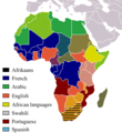
Fichièr:Official LanguagesMap-Africa.png
Official_LanguagesMap-Africa.png (360 × 392 pixèl, talha del fichièr: 21 Ko, tipe MIME: image/png)
Istoric del fichièr
Clicar sus una data e una ora per veire lo fichièr tal coma èra a aqueste moment
| Data e ora | Miniatura | Dimensions | Utilizaire | Comentari | |
|---|---|---|---|---|---|
| actual | 16 març de 2018 a 18.05 |  | 360×392 (21 Ko) | Maphobbyist | Updates |
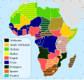
| 6 mai de 2008 a 12.54 |  | 746×813 (250 Ko) | Ant75 | Updated Madagascar to English, French and Traditional African following 2007 Constitution. | |
| 1 mai de 2008 a 12.54 |  | 720×784 (186 Ko) | Ant75 | Updated Sudan to English and Arabic following 2005 Constitution. | |
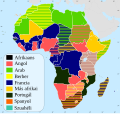
| 16 març de 2007 a 19.59 |  | 360×392 (14 Ko) | Rasulo~commonswiki | Updated earlier version due to officialization of Swahili in Uganda. Also corrected the language status of Zimbabwe where Shona and Ndebele are currently co-official with English. | |
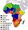
| 19 mai de 2005 a 17.05 |  | 360×392 (14 Ko) | Rydia~commonswiki | Taken from Image:BlankMap-Africa.png. Information from http://www.nationsonline.org/oneworld/index.html and CIA World Factbook {{PD}} |
Paginas que contenon lo fichièr
La pagina çaijós compòrta aqueste imatge :
Usatge global del fichièr
Los autres wikis seguents utilizan aqueste imatge :
- Utilizacion sus ca.wikipedia.org
- Utilizacion sus de.wikipedia.org
- Utilizacion sus kg.wikipedia.org
- Utilizacion sus pam.wikipedia.org


