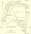
پرونده:Tetiaroa.jpg
ظاهر

اندازهٔ این پیشنمایش: ۵۵۴ × ۶۰۰ پیکسل. کیفیتهای دیگر: ۲۲۲ × ۲۴۰ پیکسل | ۶۱۷ × ۶۶۸ پیکسل.
پروندهٔ اصلی (۶۱۷ × ۶۶۸ پیکسل، اندازهٔ پرونده: ۱۱۱ کیلوبایت، نوع MIME پرونده: image/jpeg)
تاریخچهٔ پرونده
روی تاریخ/زمانها کلیک کنید تا نسخهٔ مربوط به آن هنگام را ببینید.
| تاریخ/زمان | بندانگشتی | ابعاد | کاربر | توضیح | |
|---|---|---|---|---|---|
| کنونی | ۱۸ ژانویهٔ ۲۰۱۴، ساعت ۰۸:۰۰ |  | ۶۱۷ در ۶۶۸ (۱۱۱ کیلوبایت) | Cropbot | upload cropped version, operated by User:Andy king50. Summary: cropped |
| ۲۱ اکتبر ۲۰۰۶، ساعت ۱۵:۲۳ |  | ۶۴۴ در ۷۹۷ (۹۲ کیلوبایت) | Ratzer | http://www.lib.utexas.edu/maps/historical/pacific_islands_1943_1945/tetiaroa.jpg Public domain, as explained on page http://www.lib.utexas.edu/usage_statement.html?maps=yes: "Most of the maps scanned by the University of Texas Libraries and served from t |
کاربرد پرونده
صفحهٔ زیر از این تصویر استفاده میکند:
کاربرد سراسری پرونده
ویکیهای دیگر زیر از این پرونده استفاده میکنند:
- کاربرد در als.wikipedia.org
- کاربرد در az.wikipedia.org
- کاربرد در ca.wikipedia.org
- کاربرد در de.wikipedia.org
- کاربرد در en.wikipedia.org
- کاربرد در eo.wikipedia.org
- کاربرد در es.wikipedia.org
- کاربرد در fr.wikipedia.org
- کاربرد در gl.wikipedia.org
- کاربرد در hu.wikipedia.org
- کاربرد در mk.wikipedia.org
- کاربرد در no.wikipedia.org
- کاربرد در pl.wikipedia.org
- کاربرد در pt.wikipedia.org
- کاربرد در ru.wikipedia.org
- کاربرد در sv.wikipedia.org
- کاربرد در zh.wikipedia.org
