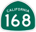
Size of this PNG preview of this SVG file: 449 × 401 pixels. Other resolutions: 269 × 240 pixels | 538 × 480 pixels | 860 × 768 pixels | 1,147 × 1,024 pixels | 2,293 × 2,048 pixels.
Original file (SVG file, nominally 449 × 401 pixels, file size: 15 KB)
File history
Click on a date/time to view the file as it appeared at that time.
| Date/Time | Thumbnail | Dimensions | User | Comment | |
|---|---|---|---|---|---|
| current | 18:12, 20 March 2006 |  | 449 × 401 (15 KB) | SPUI~commonswiki | {{spuiother}} 28 in by 25 in California State Route shield, made to the specifications of the [http://www.dot.ca.gov/hq/traffops/signtech/signdel/specs/G28-2.pdf 1971 Caltrans sign drawing] (still in use). Uses the [http://www.triskele.com/fonts/index.htm |
File usage
The following 22 pages use this file:
- California State Route 167
- California State Route 168
- California State Route 169
- California State Route 180
- California State Route 266
- California State Route 41
- Central California
- Eastern California
- Fresno County, California
- Inyo County, California
- List of highways numbered 168
- List of mountain passes in California
- List of state highways in California
- Metropolitan Fresno
- Mono County, California
- Northern California
- U.S. Route 395 in California
- Westgard Pass
- User:Ejells2/sandbox
- User:Hike395/Eastern California
- User:Tv's emory/Sandbox/List of state highways in California
- Wikipedia:WikiProject U.S. Roads/Redirects/California
Global file usage
The following other wikis use this file:
- Usage on de.wikipedia.org
- Usage on en.wikivoyage.org
- Usage on es.wikipedia.org
- Usage on et.wikipedia.org
- Usage on fr.wikipedia.org
- Usage on it.wikipedia.org
- Usage on ja.wikipedia.org
- Usage on ml.wikipedia.org
- Usage on nl.wikipedia.org
- Usage on pt.wikipedia.org
- Usage on ru.wikipedia.org
- Usage on www.wikidata.org
- Usage on zh-min-nan.wikipedia.org
- Usage on zh.wikipedia.org
