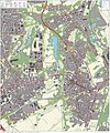
Datei:Kerkrade-topografie.jpg
Zur Navigation springen
Zur Suche springen

Größe dieser Vorschau: 374 × 599 Pixel. Weitere Auflösungen: 150 × 240 Pixel | 300 × 480 Pixel | 479 × 768 Pixel | 1.132 × 1.813 Pixel
Originaldatei (1.132 × 1.813 Pixel, Dateigröße: 1,44 MB, MIME-Typ: image/jpeg)
Dateiversionen
Klicke auf einen Zeitpunkt, um diese Version zu laden.
| Version vom | Vorschaubild | Maße | Benutzer | Kommentar | |
|---|---|---|---|---|---|
| aktuell | 20:58, 11. Jan. 2013 |  | 1.132 × 1.813 (1,44 MB) | Janwillemvanaalst | Added various topographic improvements, which were already available in the BRT open-geodata source files: - Symbols for special physical appearances of land types such as "swampy terrain" - Symbol for carpool parking + large open parking spaces (in ad... |
| 20:35, 4. Jan. 2013 |  | 1.132 × 1.813 (1,38 MB) | Janwillemvanaalst | Various rendering improvements, following the advice of several topographic experts. Scale remains unchanged. | |
| 14:01, 30. Dez. 2012 |  | 1.132 × 1.813 (1,33 MB) | Janwillemvanaalst | Map redrawn using updated (Dec. 2012) open geodata Dutch government base registries BRT + BAG. Rendered using QuantumGIS and Photoshop. | |
| 16:23, 16. Mär. 2012 |  | 2.426 × 2.900 (2,7 MB) | Janwillemvanaalst | Building polygons within Dutch national boundary now taken from Open Geodata BAG registry (Jan. 2012); increased image resolution. | |
| 13:40, 17. Feb. 2012 |  | 1.515 × 1.932 (1,62 MB) | Janwillemvanaalst |
Dateiverwendung
Die folgende Seite verwendet diese Datei: