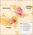
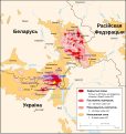
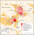
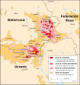
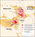
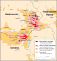
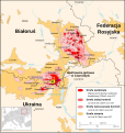
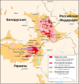
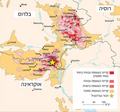
File:Chornobyl radiation map.jpg
From Wikimedia Commons, the free media repository
Jump to navigation
Jump to search

Size of this preview: 556 × 600 pixels. Other resolutions: 222 × 240 pixels | 445 × 480 pixels | 712 × 768 pixels | 1,070 × 1,154 pixels.
Original file (1,070 × 1,154 pixels, file size: 237 KB, MIME type: image/jpeg)
File information
Structured data
Captions
Captions
Add a one-line explanation of what this file represents
Summary
[edit]| DescriptionChornobyl radiation map.jpg |
中文:切尔诺贝利核电站事故后周边地区受到核辐射的剂量示意图。 |
| Date | |
| Source |
English: "Courtesy of the University of Texas Libraries, The University of Texas at Austin." See [1]; from the CIA Handbook of International Economic Statistics
|
| Author |
This file is lacking author information.
|
| Other versions |
[edit]
|
Licensing
[edit]| Public domainPublic domainfalsefalse |
| This image is a work of a Central Intelligence Agency employee, taken or made as part of that person's official duties. As a Work of the United States Government, this image or media is in the public domain in the United States.
čeština ∙ Deutsch ∙ eesti ∙ English ∙ español ∙ français ∙ italiano ∙ português ∙ polski ∙ sicilianu ∙ slovenščina ∙ suomi ∙ Tiếng Việt ∙ български ∙ македонски ∙ русский ∙ українська ∙ বাংলা ∙ മലയാളം ∙ 한국어 ∙ 日本語 ∙ 中文 ∙ 中文(简体) ∙ 中文(繁體) ∙ العربية ∙ پښتو ∙ +/− |

|
File history
Click on a date/time to view the file as it appeared at that time.
| Date/Time | Thumbnail | Dimensions | User | Comment | |
|---|---|---|---|---|---|
| current | 21:32, 25 December 2005 |  | 1,070 × 1,154 (237 KB) | Redline (talk | contribs) | "Courtesy of the University of Texas Libraries, The University of Texas at Austin." See [http://www.lib.utexas.edu/maps/belarus.html]; from the CIA Handbook of International Economic Statistics. 1996 {{PD-USGov}} |
You cannot overwrite this file.
File usage on Commons
The following 19 pages use this file:
- File:Chernobyl radiation map 1996-ar.svg
- File:Chernobyl radiation map 1996-el.svg
- File:Chernobyl radiation map 1996-lt.svg
- File:Chernobyl radiation map 1996.svg
- File:Chernobyl radiation map 1996 ko.svg
- File:Chornobyl radiation 1996 (uk).svg
- File:Chornobyl radiation map.jpg
- File:Tchernobyl radiation 1996-be.svg
- File:Tchernobyl radiation 1996-ca.svg
- File:Tchernobyl radiation 1996-de.svg
- File:Tchernobyl radiation 1996-es.svg
- File:Tchernobyl radiation 1996-it.svg
- File:Tchernobyl radiation 1996-pl.svg
- File:Tchernobyl radiation 1996-ru.svg
- File:Tchernobyl radiation 1996-ru be-x-old.svg
- File:Tchernobyl radiation 1996-ru sr.svg
- File:Tchernobyl radiation 1996.svg
- File:Tchernobyl radiation 1996 eo.svg
- Template:Other versions/Tchernobyl radiation 1996
File usage on other wikis
The following other wikis use this file:
- Usage on de.wikipedia.org
- Usage on en.wikinews.org
- Usage on he.wikipedia.org
- Usage on ja.wikipedia.org
- Usage on kn.wikipedia.org
- Usage on nl.wikipedia.org
- Usage on sh.wikipedia.org
- Usage on vi.wikipedia.org
- Usage on zh.wikipedia.org


