File:München - Basiskarte farbig - mit Nachbargemeinden.jpg

Size of this preview: 684 × 599 pixels. Other resolutions: 274 × 240 pixels | 548 × 480 pixels | 877 × 768 pixels | 1,169 × 1,024 pixels | 2,338 × 2,048 pixels | 10,375 × 9,088 pixels.
Original file (10,375 × 9,088 pixels, file size: 14.24 MB, MIME type: image/jpeg)
File information
Structured data
Captions
Captions
Add a one-line explanation of what this file represents
| Warning | The original file is very high-resolution. It might not load properly or could cause your browser to freeze when opened at full size. | Open in ZoomViewer |
|---|
| DescriptionMünchen - Basiskarte farbig - mit Nachbargemeinden.jpg |
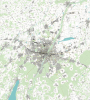
English: This map of Munich was created from OpenStreetMap project data, collected by the community. This map may be incomplete, and may contain errors. Don't rely solely on it for navigation. |
| Date | see file history |
| Source | OpenStreetMap data exported an adapted by myself |
| Author | OpenStreetMap contributors |
| Permission (Reusing this file) |
All OpenStreetMap data and maps are Creative Commons "CC-BY-SA 2.0" licensed This file is licensed under the Creative Commons Attribution-Share Alike 2.0 Generic license.
|
| Other versions |
Region München:
Stadt München:
|
File history
Click on a date/time to view the file as it appeared at that time.
| Date/Time | Thumbnail | Dimensions | User | Comment | |
|---|---|---|---|---|---|
| current | 05:30, 19 June 2010 |  | 10,375 × 9,088 (14.24 MB) | Chumwa (talk | contribs) | {{Information |Description={{en|This map of Munich was created from OpenStreetMap project data, collected by the community.<br/><small>This map may be incomplete, and may contain errors. Don't rely solely on it for navigation.</small>}} |Source=[[Open |
You cannot overwrite this file.
File usage on Commons
The following 34 pages use this file:
- User:Chumwa/Gallery
- User:Chumwa/OtherVersions - Karten München
- File:Administrative boundaries of the borough of Solln in Munich.png
- File:Basiskarte Kiel.png
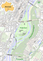
- File:Karte Flaucher München.png
- File:Karte München - WirtshausWiesn 2020.png
- File:Karte München Basiskarte.jpg
- File:Karte München Basiskarte.png
- File:Karte München Landnutzung.png
- File:Karte München Schwarzplan.png
- File:Karte München ÖPNV.png
- File:Karte München Übersichtsplan.png
- File:Karte Streetlife München.png
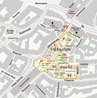
- File:Karte Viktualienmarkt München.png
- File:Karte der Burgfrieden von München.png
- File:Karte der Denkmalschutzensembles in München.jpg
- File:Karte der Gemarkungen in München.png
- File:Karte der Gemarkungen und Stadtbezirke in München.png
- File:Karte der Ortsbezeichnungen in München.png
- File:Karte der Parkstadt Bogenhausen in München.png
- File:Karte der Stadtbezirke in München.png
- File:Karte der Stadtbezirke in München in der bis 1992 gültigen Gliederung.png
- File:Karte der Stadtbezirksteile in München.png
- File:München - Basiskarte farbig.pdf
- File:München - Basiskarte farbig.png
- File:München - Basiskarte farbig - mit Nachbargemeinden.jpg
- File:München - Basiskarte farbig - mit Nachbargemeinden.png
- File:München - Basiskarte grau.pdf
- File:München - Basiskarte grau.png
- File:München - Stadtbezirke (Karte).png
- File:Positionskarte München.png
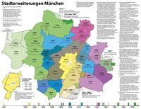
- File:Stadterweiterungen München.png
- File:Westpark München (Karte).png
- File:Westpark München zur IGA 1983 (Karte).png
Metadata
This file contains additional information such as Exif metadata which may have been added by the digital camera, scanner, or software program used to create or digitize it. If the file has been modified from its original state, some details such as the timestamp may not fully reflect those of the original file. The timestamp is only as accurate as the clock in the camera, and it may be completely wrong.
| Orientation | Normal |
|---|---|
| Horizontal resolution | 72 dpi |
| Vertical resolution | 72 dpi |
| Software used | Adobe Photoshop CS4 Windows |
| File change date and time | 07:19, 19 June 2010 |
| Color space | Uncalibrated |
